
The Pennine Way is 268 miles of British backbone. It runs from Edale in Derbyshire all the way to Kirk Yetholm just across the Scottish border, threading through some of the most dramatic, boggy, and genuinely wild landscape this island has to offer. Most people who know it think of it as a multi-week thru-hike for the dedicated and the slightly unhinged. But that framing does it a disservice. Some of the best Pennine Way day walks sections are accessible to anyone with decent boots, a map, and a reasonable level of fitness. You don’t need to commit to the whole thing to get the best of it.
Breaking it into day sections also means you can be selective. The Pennine Way has its dull patches, stretches of gravel track or monotonous moorland where the scenery flatlines for a while. Going section by section means you get to cherry-pick the highlights, return home each evening, and leave the blister-management drama to the thru-hikers.
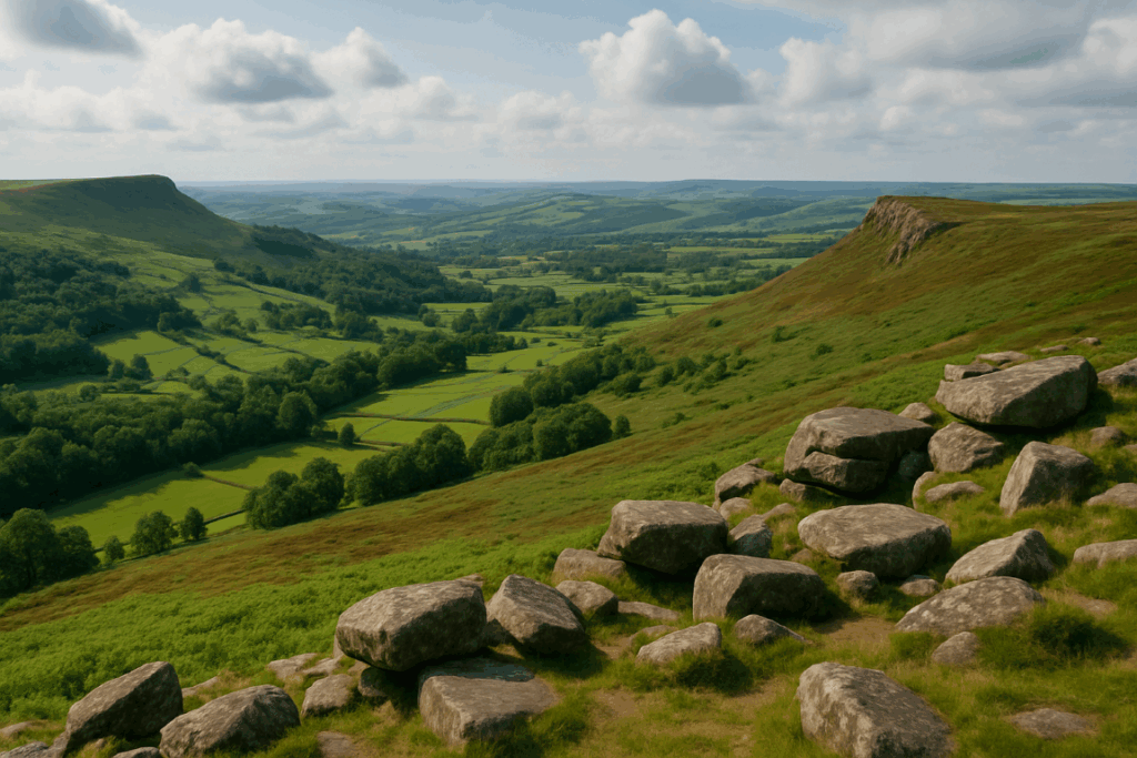
Kinder Scout and the Bleaklow: Where the Pennine Way Begins
The opening section from Edale to Crowden, roughly 25 miles in total, is split nicely into two solid days if you’re walking out and back or using local transport. The climb up onto Kinder Scout via Grindsbrook Clough is properly atmospheric, especially on a grey morning when cloud sits low over the plateau. The gritstone edges, the peat hags, the strange rock formations at Kinder Downfall; it feels like a different country up there compared to the valley below.
From Kinder, the route drops and climbs again onto Bleaklow, which is rawer and more exposed. This is one of the most iconic Pennine Way day walks sections, and it’s not easy. Navigation on the plateau can be genuinely tricky in poor visibility. But on a clear day, the views across to Stanage Edge and beyond are worth every step of the boggy approach. The Snake Pass road gives you a logical cut-off point for a day section from Edale.
Malham to Horton-in-Ribblesdale: Limestone Country
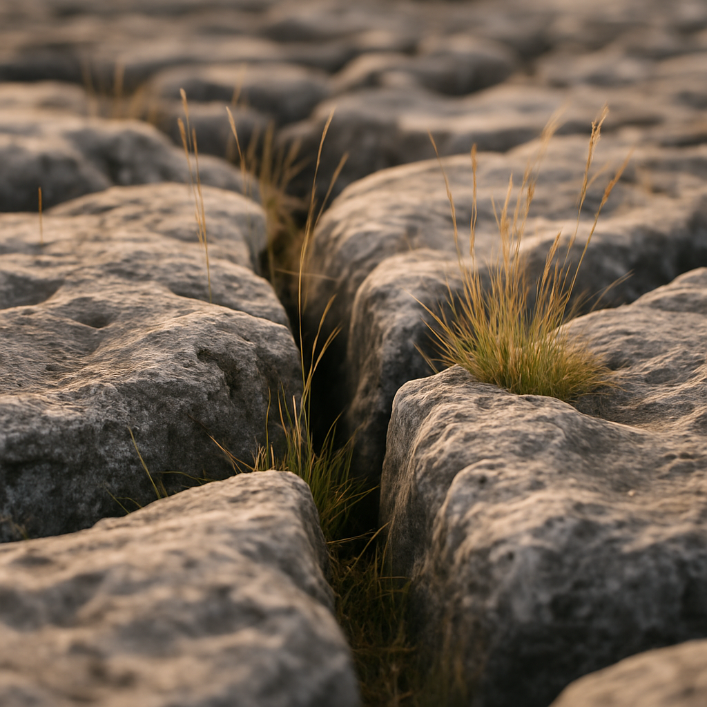
If you only do one stretch of the Pennine Way as a day walk, make it this one. The section from Malham village, through Malham Cove, across the limestone pavement, up to Malham Tarn, and then onward towards Pen-y-ghent is genuinely world-class walking. The cove itself is a 70-metre limestone cliff formed by glacial meltwater. Stand at the top of the pavement and look back down the valley and it’s hard to believe you’re still in England.
Pen-y-ghent, one of the Yorkshire Three Peaks, sits at 694 metres and has a pleasingly abrupt summit. The final scramble to the top along the gritstone and limestone ridge gives the day a proper climax. Horton-in-Ribblesdale has a pub, a car park, and a railway station on the Settle-Carlisle line, making it an excellent finishing point. Public transport back to Malham is awkward, so check the Dales Bus timetable or arrange a pick-up in advance.
High Cup Nick and the Approach to Cross Fell
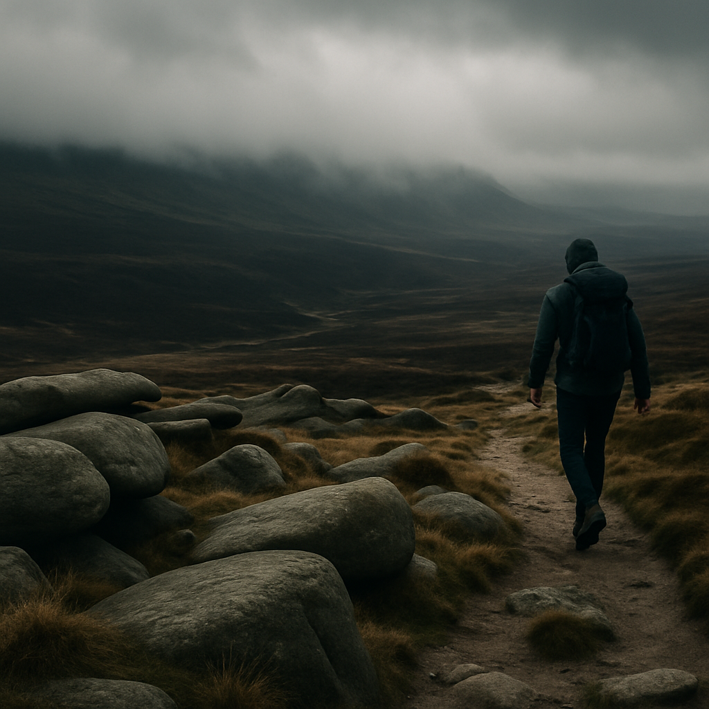
This is one of those places that stops you mid-stride. High Cup Nick, reached from Dufton in Cumbria, is a U-shaped glacial valley with sheer dolerite columns dropping away on both sides. It appears suddenly as you crest the moor, and the drop into the valley below is vertiginous. There’s nothing quite like it on the route.
From Dufton you can extend the walk northwards to Cross Fell, the highest point on the entire Pennine Way at 893 metres. This is serious upland walking. The summit plateau is vast and featureless, the weather changes quickly, and the Helm Wind that funnels off these fells is notorious locally. But standing on the highest point in the Pennines on a fine day, with views stretching from the Lake District to the North York Moors, feels like a genuine reward. The return to Dufton makes for a long day, around 20 miles with significant ascent, so start early and take warm layers regardless of the morning forecast.
Hadrian’s Wall Country: Vindolanda to Greenhead
The Pennine Way briefly runs alongside Hadrian’s Wall in Northumberland, and this section is extraordinary for entirely different reasons. You’re walking through 2,000 years of history, along the whinstone ridge where the Romans built their frontier. The crags of Cawfield and Walltown give the landscape a muscular, dramatic quality quite unlike the peat moors further south.
The English Heritage managed sites along Hadrian’s Wall include Vindolanda and Housesteads, both worth factoring into a day walk in this section. The walking itself is undulating and relatively short in mileage, but absorbing in a way that few stretches of the route manage. It’s also one of the more accessible Pennine Way day walks sections for families or those who prefer history with their hiking.
The Northumberland Moorland: Bellingham to the Border
The final miles of the Pennine Way through Northumberland feel genuinely remote. This is England’s emptiest county, and the moorland between Bellingham and Kirk Yetholm has a bleakness that feels earned. The Cheviot Hills roll in wave after wave, and the path over The Cheviot itself at 815 metres is often boggy even in summer.
The last day into Kirk Yetholm via the Schil is one of the best of the lot. There’s a quiet satisfaction to walking the final ridge knowing the border is close, even if you haven’t done the 267 miles before it. As a standalone day section from Byrness into the Cheviots, it gives you a taste of proper border country without requiring a fortnight of preparation.
Practical Notes for Walking Individual Sections
Public transport is patchy but workable along most of the route. The Settle-Carlisle railway is invaluable for the Yorkshire Dales sections, and the Northern Rail network serves Edale well. For Northumberland, you’ll need to plan more carefully; Hadrian’s Wall Country Bus (AD122) runs seasonally and covers the central section well. Always check current timetables before you go.
The official National Trails website has GPX files and detailed maps for every section of the route. Download the relevant stretch before you head out rather than relying on mobile signal on the moors. Navigation on the Pennine Way varies enormously; some sections are heavily waymarked, others require proper compass and map work, particularly on the high plateau sections around Kinder and Cross Fell.
Parking at trailheads is limited in many places. Malham and Edale get extremely busy on summer weekends. Arriving early or using the train genuinely improves the experience. And carry more water than you think you need. The moorland sections have very few reliable sources, and the ones that look clean on a map can be stagnant by August.
The Pennine Way doesn’t have to be a full-commitment expedition. Walk the sections that draw you, come back for more when they do, and let the route reveal itself at your own pace. That’s not the lesser version of the experience. It might actually be the better one.
Frequently Asked Questions
What are the easiest Pennine Way day walks sections for beginners?
The Malham Cove and limestone pavement section from Malham village is one of the most accessible, with well-marked paths and manageable terrain. The Hadrian’s Wall stretch near Housesteads is also relatively short and very well waymarked, making it a good starting point for those new to upland walking.
Can you walk individual sections of the Pennine Way as out-and-back day hikes?
Yes, many sections work well as out-and-back walks, particularly those starting from car parks or villages with good facilities. However, using public transport or arranging a car shuttle between two trailheads gives you more flexibility and avoids retracing your steps on long sections.
How long does a typical Pennine Way day walk section take?
Most standalone sections cover between 10 and 20 miles and take anywhere from 4 to 8 hours depending on pace, fitness, and conditions underfoot. Sections like Kinder Scout to Snake Pass or Dufton to Cross Fell are full day outings; Malham Cove to Horton-in-Ribblesdale can be done comfortably in around 6 hours.
Do I need a permit or permission to walk sections of the Pennine Way?
No permit is required. The Pennine Way is a designated National Trail with public right of way along its entire length, so you are free to walk any section without permission. It passes through national parks including the Peak District, Yorkshire Dales, and Northumberland, all of which are publicly accessible.
What is the toughest day section on the Pennine Way?
The crossing from Edale to Crowden via Kinder Scout and Bleaklow is widely regarded as one of the hardest, combining significant ascent with notoriously difficult navigation across peat moorland. The Cross Fell section from Dufton is also demanding due to its length, elevation, and exposure to rapid weather changes.