Category: Mother Nature

  • The World’s Most Extreme Long-Distance Trails and Whether You Could Actually Hike Them

    The World’s Most Extreme Long-Distance Trails and Whether You Could Actually Hike Them

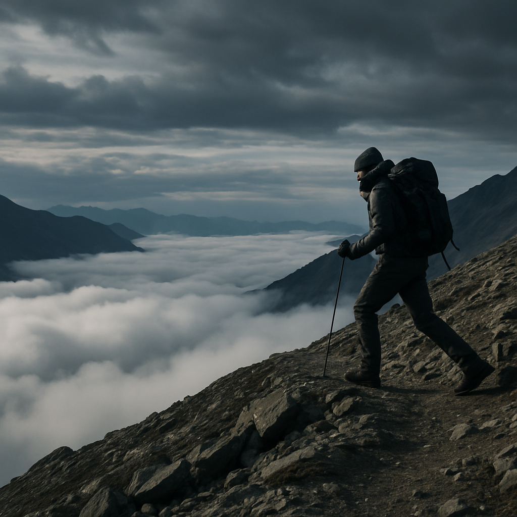
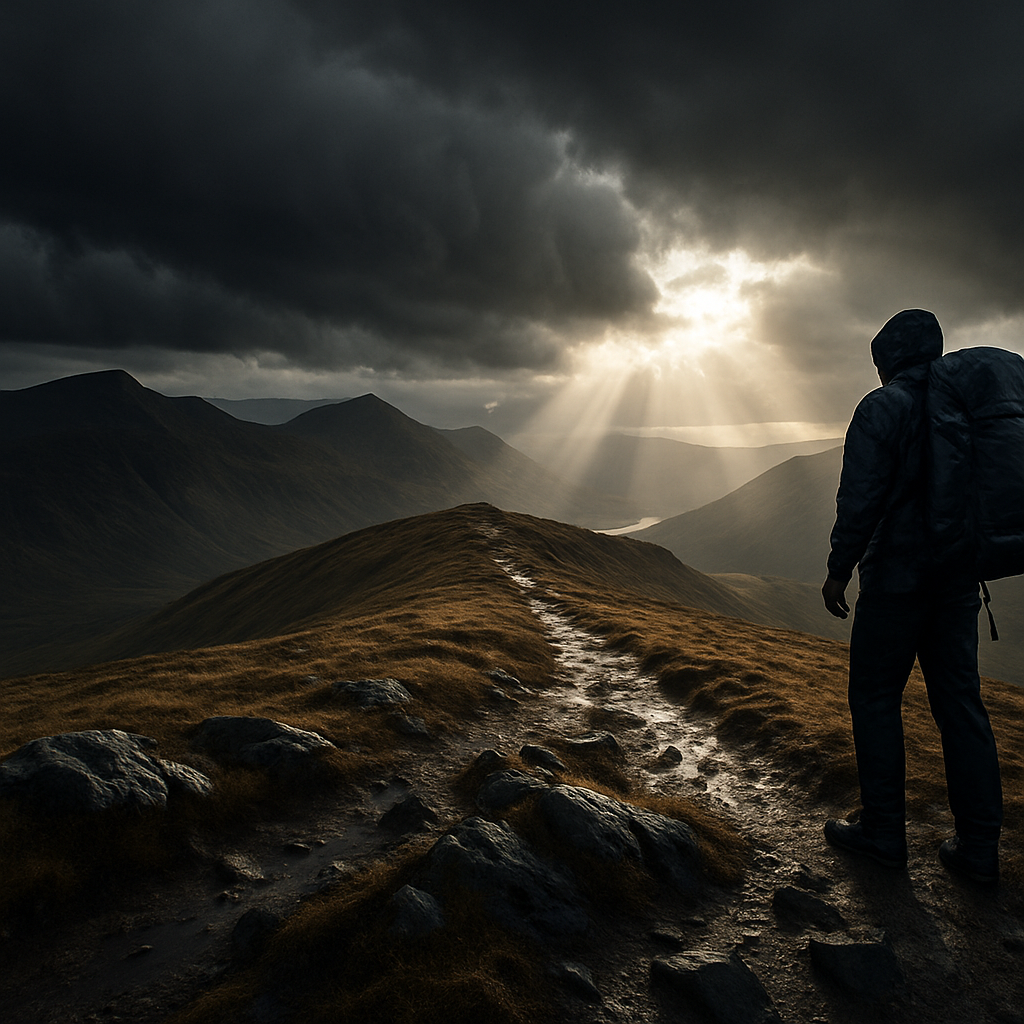
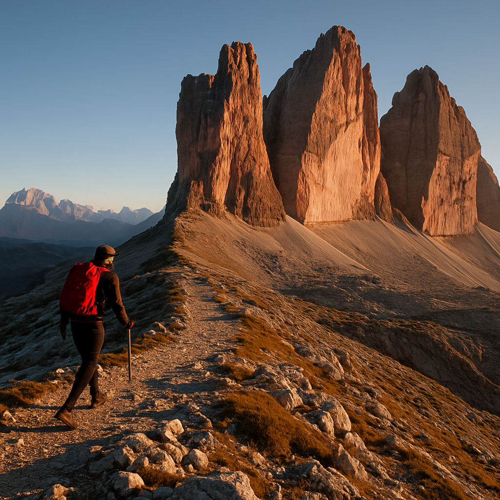
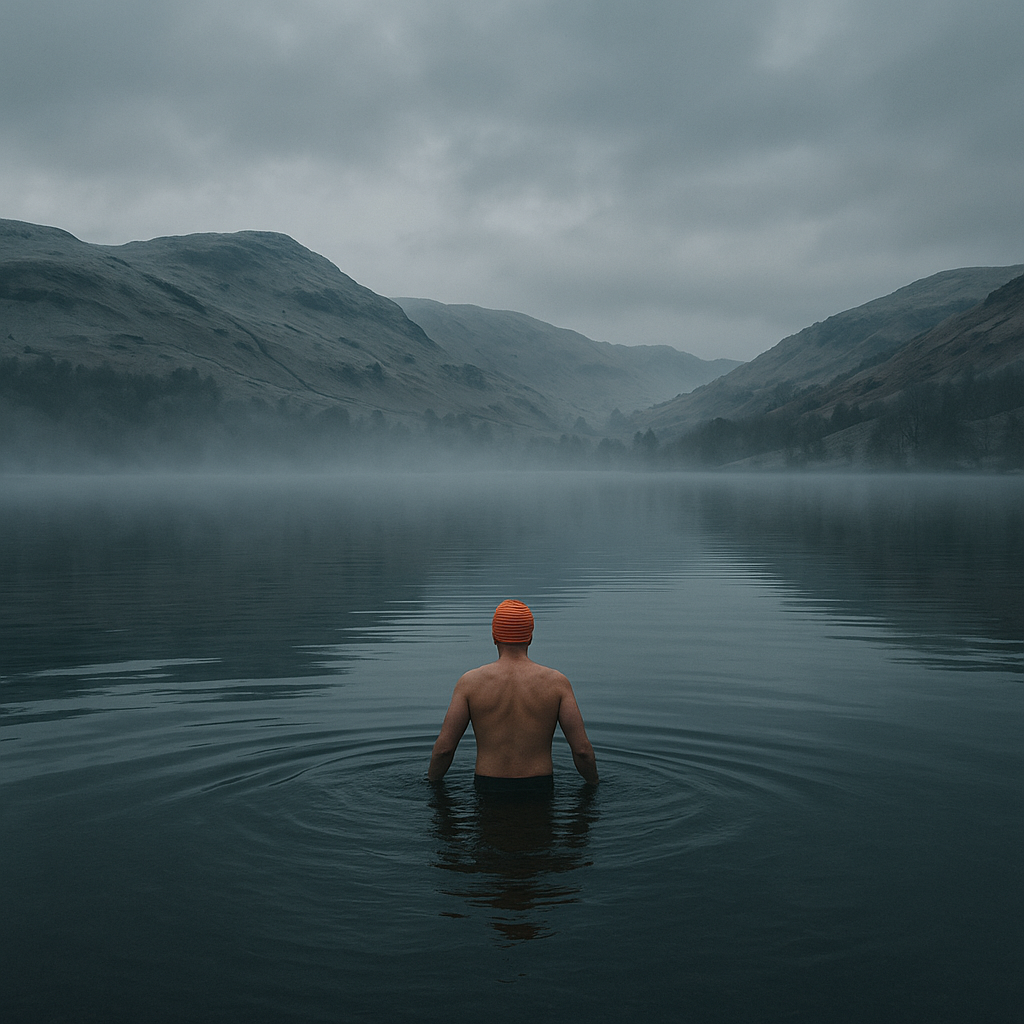
    Some trails are long. Others are legendary. And then there are the routes that quietly rearrange your sense of what a human body can actually endure. Extreme long distance hiking trails sit in a category of their own: months on foot, thousands of metres of elevation, weather that does not care about your plans, and a mental grind that breaks people far fitter than they expected. I’ve stood at the foot of enough serious hills to know that ambition and fitness are very different things, and both matter enormously before you commit to something like this.

    This is not a list designed to put you off. It’s an honest look at what these routes actually demand, and whether you’re the kind of person who could realistically take one on.

    Hiker on a remote mountain ridge representing the challenge of extreme long distance hiking trails
    Hiker on a remote mountain ridge representing the challenge of extreme long distance hiking trails

    The Pacific Crest Trail: 2,650 Miles of Brutal Beauty

    The Pacific Crest Trail, stretching from the Mexican border near Campo, California all the way to Manning Park in British Columbia, Canada, is probably the most romanticised of all extreme long distance hiking trails. Cheryl Strayed’s memoir made it famous. What the memoir doesn’t linger on quite so long is the snow. The Sierra Nevada in early season can be genuinely dangerous, with hikers postholing through metres of white without proper crampons or ice axes. Most thru-hikers take five to six months. The total elevation gain across the route is roughly 135,000 metres, which puts it somewhere between “relentless” and “ridiculous”.

    Permits are required and competitive. US visas or ESTA are needed for British hikers, and border crossings require documentation. If you’re serious, the BBC’s endurance sport coverage frequently highlights how British athletes approach multi-month challenges, including trail endurance events, which can give you a solid frame of reference. The PCT Association recommends at least 800 miles of prior backpacking experience before attempting a thru-hike. Not day walks. Backpacking.

    The Appalachian Trail: Mud, Humidity and 2,190 Miles

    The Appalachian Trail runs from Springer Mountain in Georgia to Mount Katahdin in Maine, and it has a completion rate hovering around 25%. That number alone should tell you something. The AT is famous for its relentless terrain, its notorious mud (especially in the south and in Vermont), and a humidity level in summer that makes the Scottish Highlands feel like a desert.

    What catches people out most is not the big mountains. It’s the cumulative nature of thousands of smaller climbs, day after day, with no flat respite. Average thru-hikers cover about 25 to 30 kilometres per day in their later weeks, but many burn out in the first month trying to do too much too soon. Gear selection matters enormously here. Lightweight matters. Blister management matters. And so does your ability to sit inside a dripping shelter for three days straight without losing your mind.

    Muddy hiking boots on a boulder showing the wear of extreme long distance hiking trails
    Muddy hiking boots on a boulder showing the wear of extreme long distance hiking trails

    The Te Araroa: New Zealand’s 3,000 km Spine

    If you want something that feels more remote than the American mega-trails, New Zealand’s Te Araroa covers roughly 3,000 kilometres from Cape Reinga at the tip of the North Island down to Bluff at the southern end of the South Island. River crossings are not just frequent, they’re part of the route. Some are waist-deep or higher. There are no bridges. The Tararua Range section on the North Island has weather so volatile that local trampers genuinely treat it with the same respect as alpine conditions.

    New Zealand’s Department of Conservation publishes detailed safety advice and hut booking systems for multi-day routes, and it’s worth understanding the hut network before you go. Many sections of the Te Araroa pass through Department of Conservation land where the infrastructure is thin and resupply points are days apart.

    The GR20: Europe’s Hardest Long Distance Trail

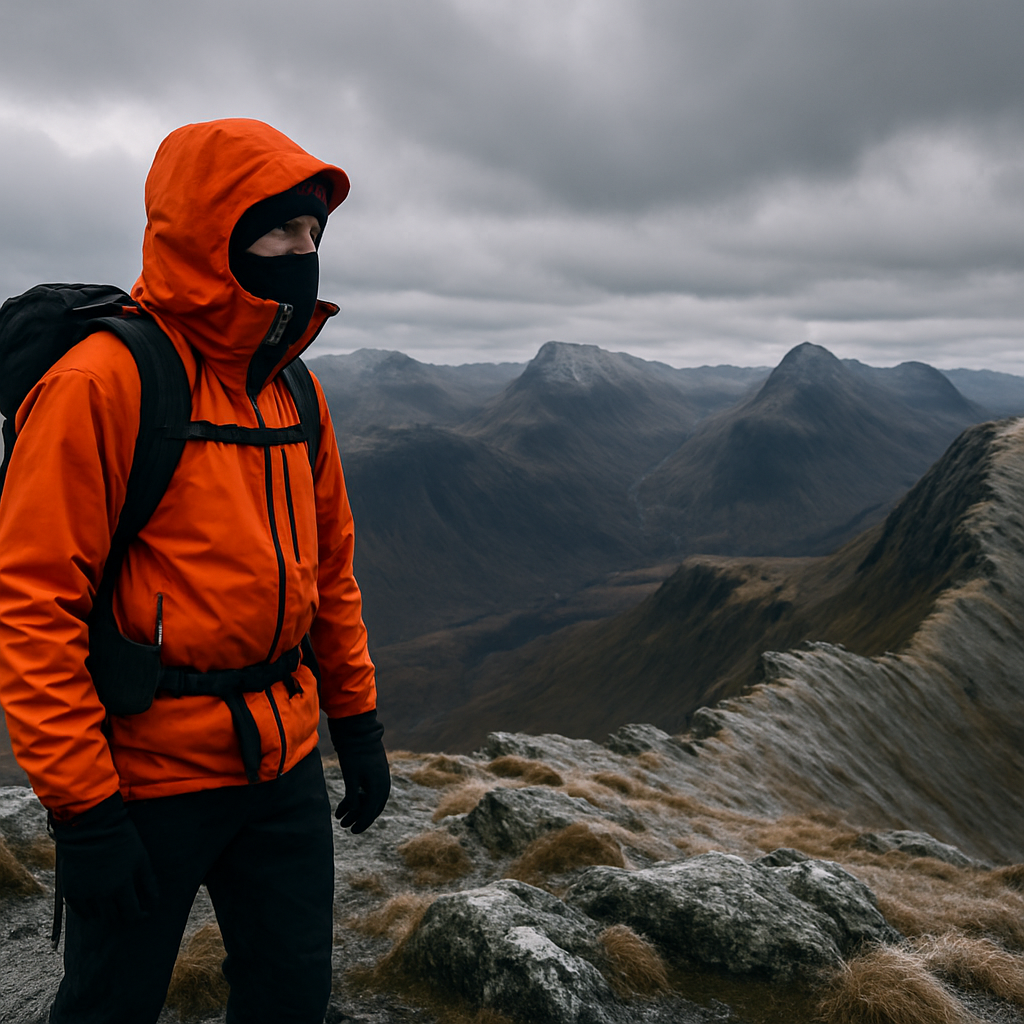
    For those who want extreme long distance hiking trails without crossing an ocean, Corsica’s GR20 is your answer. At roughly 180 kilometres, it’s far shorter than the American giants, but what it lacks in distance it compensates for in sheer vertical brutality. The trail crosses the island’s mountainous spine, often at altitude, with exposed scrambling sections, minimal shade, and a reputation that defeats roughly a third of walkers who attempt it.

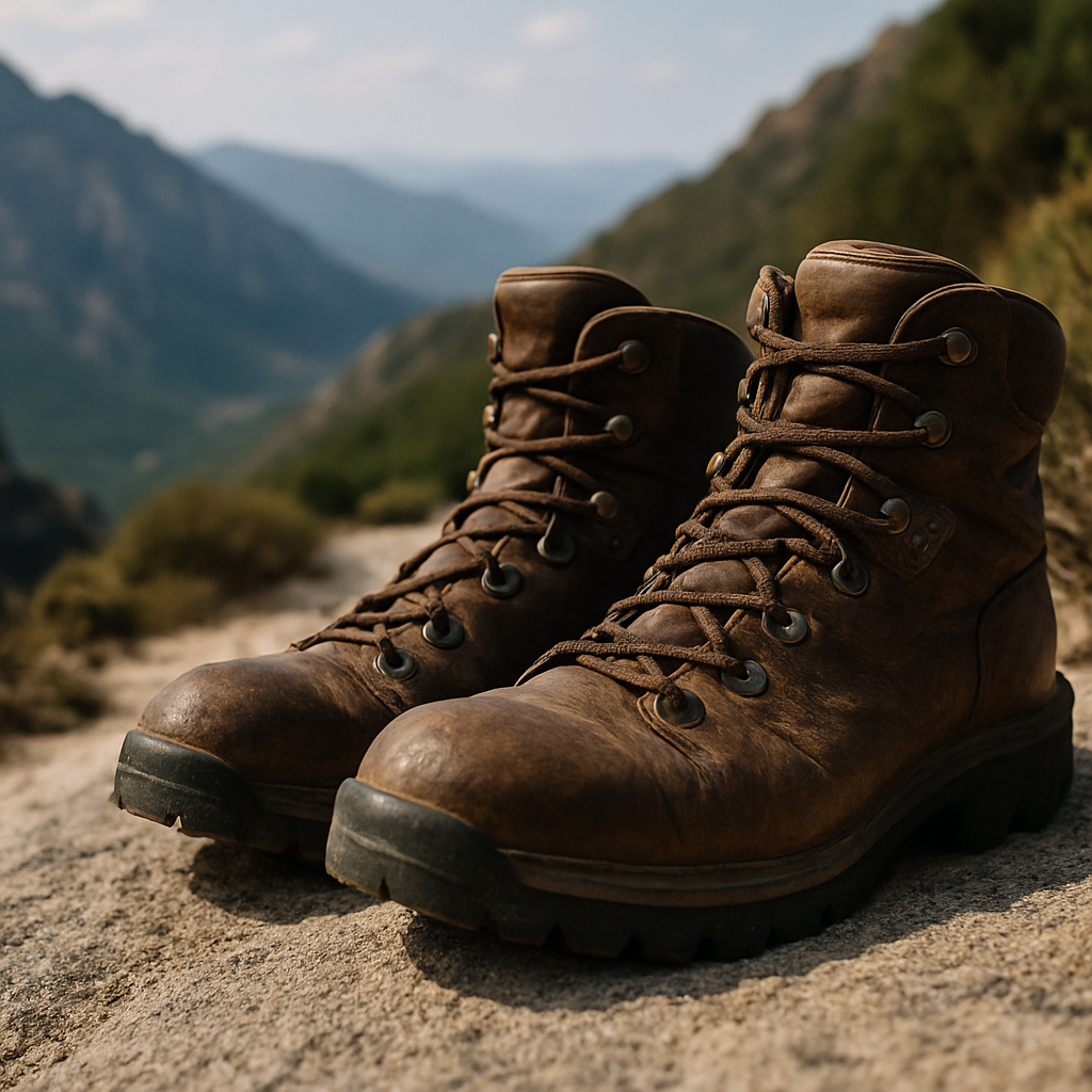
    The GR20 is genuinely achievable for experienced UK hikers. If you’ve done multi-day routes in the Scottish Highlands, carried a full pack over the Cairngorm plateau in weather, and know how to navigate in mist, you have the foundations. The rock work is the curveball. Solid boots with ankle support are essential, and a mid-summer start typically means heat that British hikers underestimate badly.

    Could You Actually Do One of These Trails?

    Honestly? Yes, probably, if you give it the preparation it deserves. Here’s what I’d say matters most, having spent a good chunk of time in UK mountains and on extended routes.

    First, mileage base. You need months of consistent hiking under your belt before you attempt anything in the extreme long distance hiking trails category. Not gym sessions. Not weekend outings every few weeks. A proper 12-week programme building from 20 kilometres per week to 60 or 70, with back-to-back long days included, is the bare minimum. The UK government’s foreign travel advice pages are also worth checking for each destination, since some of these trailheads are in regions with entry requirements, health vaccination recommendations, or seasonal alerts that change regularly.

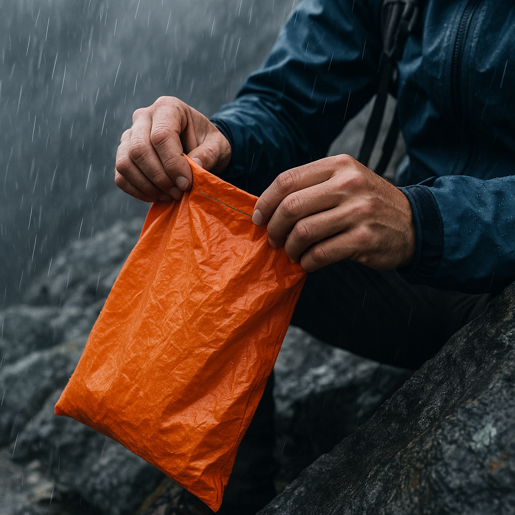
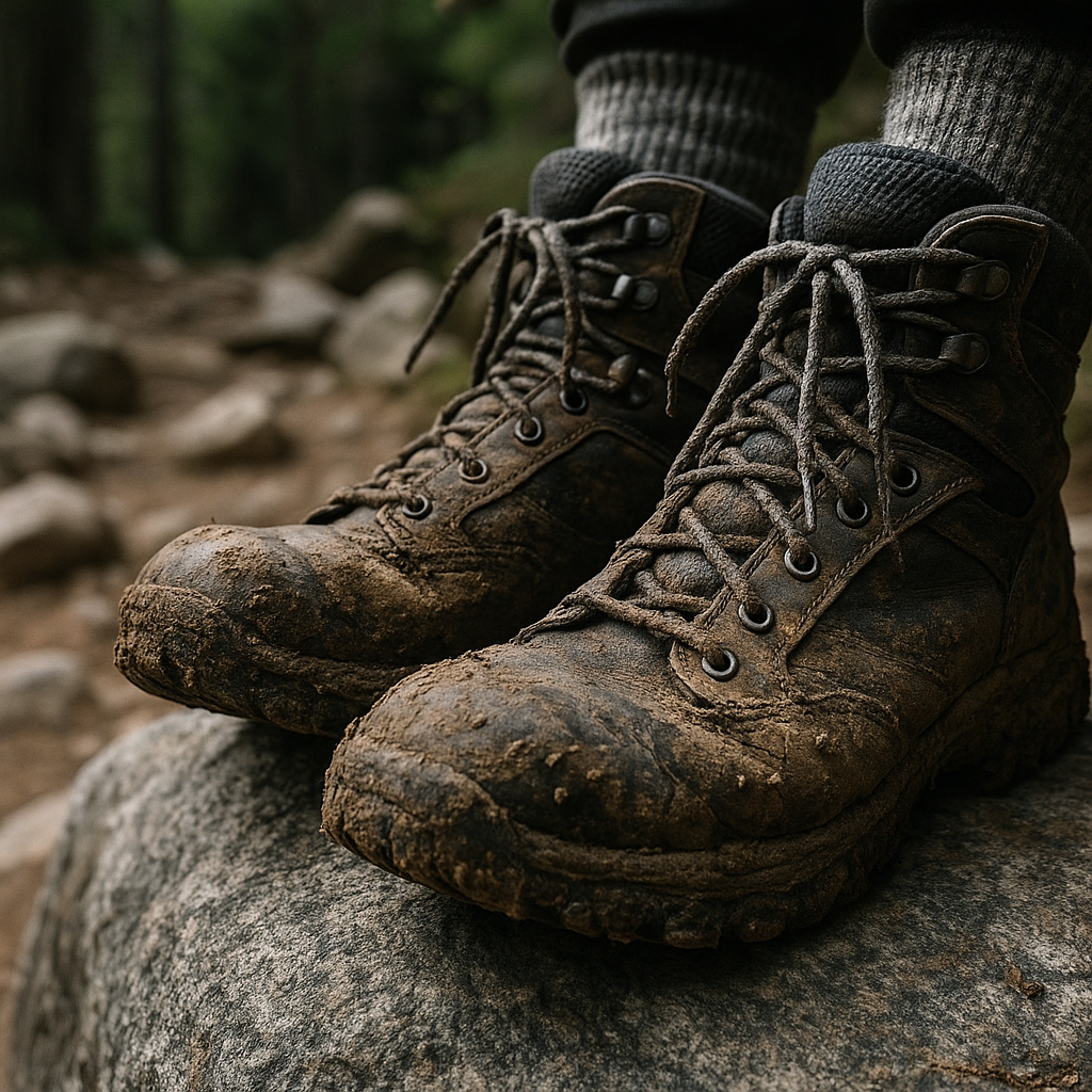
    Second, your feet. I cannot overstate this. Foot care on a thru-hike is a full-time discipline. Wet socks are the beginning of the end for many people. Learn to tape, learn to drain, learn to recognise the difference between a hot spot and a blister that’s about to sideline you for a week.

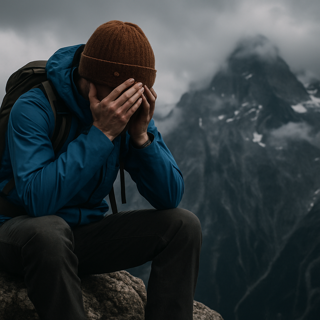
    Third, your head. The physical side of extreme long distance hiking trails is actually the part most people train for. The mental side, the weeks of repetitive effort, the loneliness, the days when your body says enough, is what sends people home. Experienced long-distance hikers often describe days 14 to 30 as the critical window. If you can get through that patch, you tend to find your rhythm.

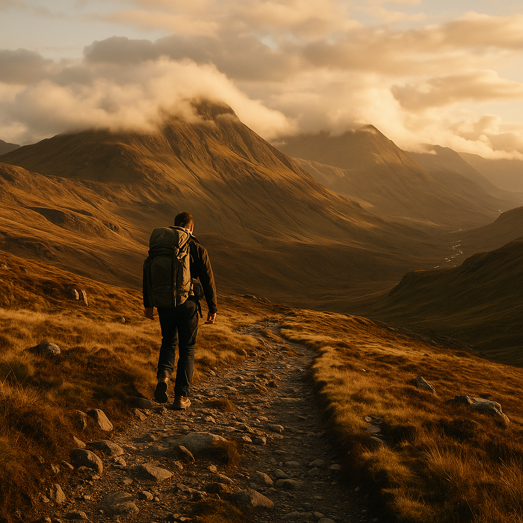
    Training in the UK Before You Go

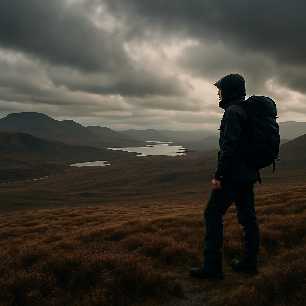
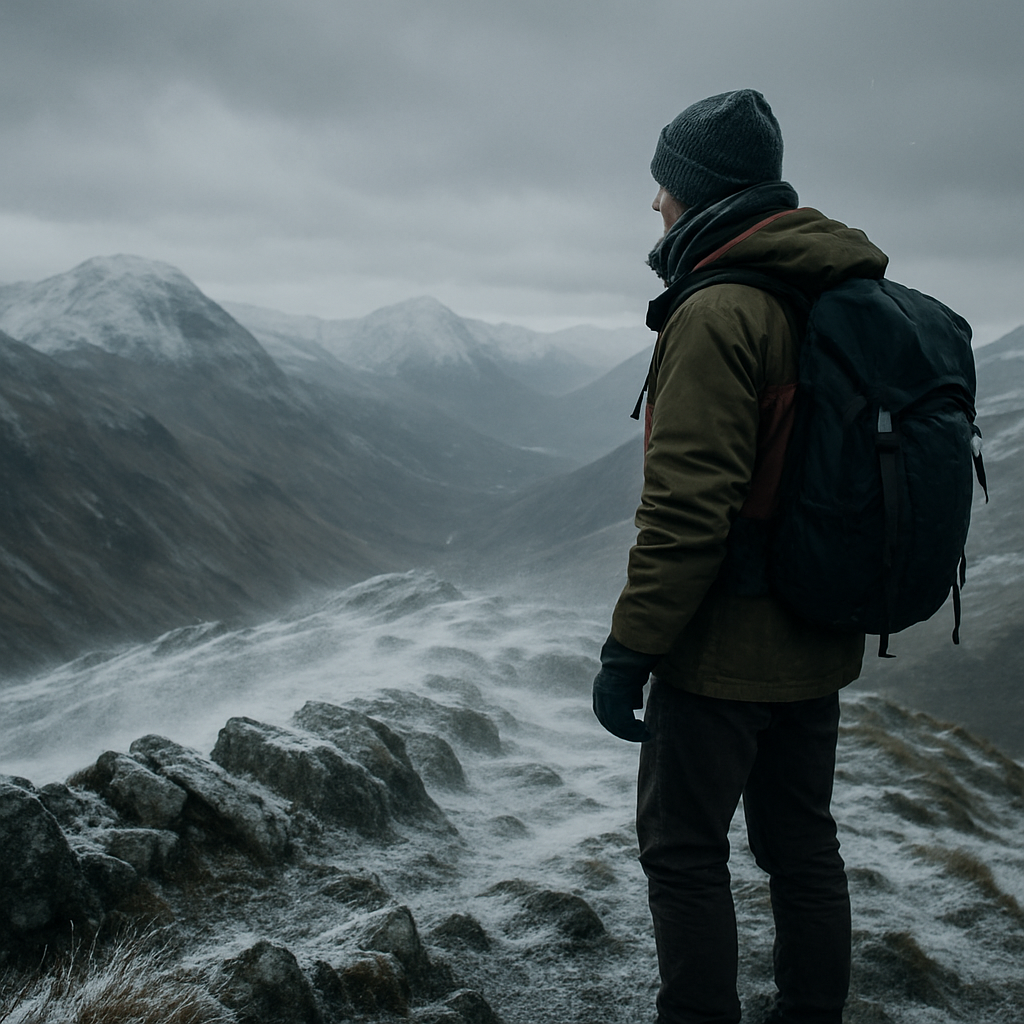
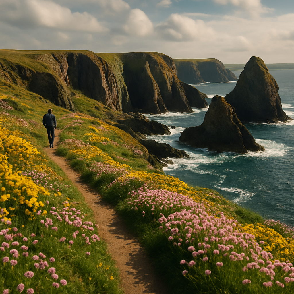
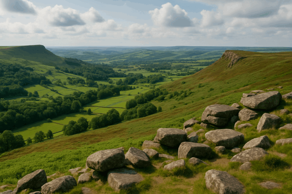
    The good news is that the UK is genuinely excellent training ground for extreme long distance routes. The Pennine Way, the Cape Wrath Trail, and the South West Coast Path all offer sustained mileage, variable weather, and genuine wildness. The Cape Wrath Trail in particular, running roughly 400 kilometres from Fort William to Cape Wrath with almost no waymarking and serious river crossings, is as close as you’ll get on British soil to the unpredictability of a major thru-hike.

    Use UK multi-day routes to test your gear, your nutrition strategy, your sleep system, and critically, your pack weight. Aim to keep your base weight (everything except water and food) under 7 kilograms. Every extra kilogram across 3,000 kilometres is a significant accumulation of strain on your knees and hips.

    The world’s great trails are not closed to you. They just require honesty about where you are versus where you need to be. Start with what you can do now, build consistently, and pick your route based on honest self-assessment rather than Instagram ambition. That’s the hiker’s way.

    Frequently Asked Questions

    How long does it take to hike the Pacific Crest Trail end to end?

    Most thru-hikers complete the Pacific Crest Trail in five to six months, typically starting northbound in late April. Some faster hikers finish in four months, but the average pace works out to around 40 to 50 kilometres per day once you’ve found your trail legs.

    What is the hardest long distance hiking trail in the world?

    This depends on how you measure difficulty. The Barkley Marathons course in Tennessee is the most punishing in terms of completion rate, but for thru-hikers the Hayduke Trail in the American Southwest and the Ouray 100 are frequently cited as brutally difficult. In Europe, the GR20 in Corsica is widely considered the hardest route, and is a realistic target for experienced UK hikers.

    Do I need prior experience before attempting an extreme long distance trail?

    Yes, genuinely. The Pacific Crest Trail Association recommends at least 800 miles of prior backpacking experience. Multi-day routes in the UK, such as the Cape Wrath Trail or the Pennine Way, are excellent preparation for understanding how your body, kit, and mindset hold up over sustained effort.

    How much does it cost to thru-hike the Appalachian Trail?

    Most AT thru-hikers budget between £5,000 and £8,000 for a full end-to-end hike, covering gear, food resupply, accommodation in trail towns, transport to and from the trailheads, and travel insurance. Costs vary widely depending on how often you stay in hostels versus camping, and how much you eat in restaurants along the way.

    Can British hikers access the major US long distance trails?

    Yes. British passport holders can enter the United States under the ESTA visa waiver programme for visits up to 90 days, but a full thru-hike typically takes five or six months, which means you’d need a B-2 tourist visa. Check the latest US entry requirements well in advance, and factor in the cost and processing time.

  • Altitude Sickness: Symptoms, Prevention, and When to Turn Back

    Altitude Sickness: Symptoms, Prevention, and When to Turn Back

    You’ve trained for months, saved up, booked the flights, and now you’re standing at base camp with the summit gleaming above you. Everything feels perfect. Then the headache arrives. A dull, persistent throb that sits behind your eyes and refuses to budge. That’s often how it starts. Altitude sickness is one of the most serious hazards facing trekkers and climbers at high elevation, and the trouble is it doesn’t care how fit you are, how many Munros you’ve bagged, or how well you slept the night before. Understanding altitude sickness symptoms prevention strategies and the hard decision of when to turn back could genuinely save your life.

    Solo hiker climbing a high-altitude mountain ridge, illustrating the risks of altitude sickness symptoms prevention
    Solo hiker climbing a high-altitude mountain ridge, illustrating the risks of altitude sickness symptoms prevention

    What Is Altitude Sickness and Why Does It Happen?

    Altitude sickness, medically known as Acute Mountain Sickness (AMS), occurs when you ascend to high elevation faster than your body can adapt to reduced air pressure and lower oxygen levels. Above roughly 2,500 metres, the drop in atmospheric pressure means each breath delivers less oxygen to your bloodstream. Your body responds by breathing faster and working harder, but the adjustment takes time. Push too high, too quickly, and things can go wrong fast.

    There are three recognised tiers of altitude illness. AMS is the mildest and most common form. High Altitude Pulmonary Oedema (HAPE) involves fluid building in the lungs. High Altitude Cerebral Oedema (HACE) involves swelling of the brain. Both HAPE and HACE are life-threatening emergencies. Knowing the difference between them and a standard headache is non-negotiable knowledge for anyone heading above 3,000 metres.

    The Early Warning Signs You Should Never Ignore

    AMS typically sets in between six and twelve hours after arriving at altitude. The symptoms are frustratingly easy to dismiss as tiredness or dehydration, which is exactly why people get into trouble.

    The classic AMS warning signs include a persistent headache, fatigue that feels disproportionate to your effort, loss of appetite, nausea, dizziness, and disturbed sleep. If you’re ticking three or more of those boxes after gaining significant elevation, treat it seriously. A useful diagnostic tool used by medical teams in the field is the Lake Louise Score, a simple questionnaire that helps quantify your symptoms and assess severity. You can find the scoring criteria via the NHS and travel health resources or through MASTA, the UK’s leading travel health clinic network.

    The danger signs that indicate progression to HAPE or HACE are a different matter entirely. Watch for extreme breathlessness at rest, a rattling cough producing pink or frothy mucus (HAPE), profound confusion, loss of coordination, inability to walk in a straight line, or someone becoming increasingly drowsy and unresponsive (HACE). If you see any of these, you are in an emergency. Descent must happen immediately.

    Trekker resting on rocks at altitude experiencing altitude sickness symptoms
    Trekker resting on rocks at altitude experiencing altitude sickness symptoms

    Altitude Sickness Symptoms Prevention: How to Acclimatise Properly

    The single most effective approach to altitude sickness symptoms prevention is giving your body enough time to adjust. This means planning your ascent profile carefully rather than simply booking the fastest route to the top.

    Climb High, Sleep Low

    This is the golden rule of acclimatisation. During the day, you can ascend to a higher altitude for exploring or training, but always come back down to sleep at a lower camp. Your body adapts most effectively while resting, and sleeping at a lower elevation reduces the stress on your system overnight.

    Follow the 300-Metre Rule Above 3,000 Metres

    Above 3,000 metres, most mountain medicine specialists recommend increasing your sleeping altitude by no more than 300 to 500 metres per day, with a rest day every three to four days. This pace might feel frustratingly slow when you’re keen to reach the summit, but it’s what keeps you alive and functional.

    Stay Hydrated and Avoid Alcohol

    Dehydration worsens AMS symptoms noticeably. Aim to drink three to four litres of water daily at altitude. Avoid alcohol in the first few days at elevation; it depresses your respiratory rate, interfering with the acclimatisation process. Strong coffee is worth limiting too, as a diuretic.

    Consider Acetazolamide (Diamox)

    Diamox is a prescription medication widely used as a preventative measure for AMS. It works by stimulating faster, deeper breathing and speeding up acclimatisation. You’ll need to speak to a travel health specialist or your GP before your trip, as it has contraindications and side effects including increased urination and tingling in the extremities. It’s not a substitute for proper acclimatisation but can be a useful tool, particularly for treks with rapid ascent profiles.

    Popular High-Altitude Destinations and What to Expect

    Most British trekkers heading into serious altitude territory are making for a handful of iconic destinations. Knowing the specific risks of each one helps you plan properly.

    Kilimanjaro, Tanzania (5,895 metres)

    One of the most popular high-altitude treks for UK travellers and also one of the most commonly underestimated. Many routes to the summit allow only four or five days for the ascent, which is genuinely too fast for most people. Studies suggest that between 25 and 75 percent of climbers on Kilimanjaro experience some form of AMS depending on the route and pace. The longer Lemosho and Northern Circuit routes offer better acclimatisation windows.

    Everest Base Camp, Nepal (5,364 metres)

    A classic itinerary typically runs fourteen to sixteen days, which builds in reasonable acclimatisation stops at Namche Bazaar and Dingboche. Even so, altitude sickness symptoms prevention needs to be taken seriously all the way, and AMS is common. The trek is well-supported with teahouses and medical posts along the route.

    Machu Picchu and the Cusco Region, Peru (3,400 metres)

    Many trekkers underestimate this one. Cusco itself sits at 3,400 metres and landing there directly from sea level frequently triggers AMS within hours. Spending a couple of days in Cusco before ascending further, or ideally visiting Sacred Valley (lower altitude) first, makes a substantial difference.

    When Descending Is No Longer Optional

    This is the part nobody wants to confront when they’re two days from a summit they’ve dreamed about for years. But altitude sickness symptoms prevention only takes you so far. Sometimes, the mountain wins, and the only right move is down.

    If AMS symptoms are worsening rather than stabilising after a rest day at the same altitude, descend. Even a drop of 300 to 500 metres can bring significant relief remarkably quickly. Do not sleep at the same altitude if symptoms are progressing.

    If there is any sign of HAPE or HACE, treat it as a life-threatening emergency. Descend immediately, even in the dark if necessary. If a portable hyperbaric chamber (Gamow bag) is available, use it while preparing for descent. Supplemental oxygen, if accessible, should be administered straight away. Dexamethasone can be used as an emergency medication for HACE; nifedipine for HAPE. These are not cures, they are holding measures to buy time for descent.

    The psychological pressure to push on is real. Guides, fellow trekkers, the financial investment, the emotional weight of turning back so close to a goal you’ve trained months for. I’ve spoken to climbers who ignored early warning signs because they didn’t want to disappoint their group. That’s a choice that has cost people their lives. No summit is worth dying for. The mountain will still be there next year.

    Before You Go: Key Practical Preparations

    Talk to a travel health specialist well before departure. MASTA clinics across the UK can provide altitude-specific advice, Diamox prescriptions if appropriate, and a full assessment of your individual risk factors. Make sure your travel insurance explicitly covers high-altitude trekking and emergency evacuation, as standard policies frequently exclude activities above a certain elevation. According to the Foreign, Commonwealth and Development Office travel advice pages, it’s vital to check coverage before heading to remote regions where medical facilities are hours or days away.

    Pack a basic first aid kit that includes blister treatment and basic analgesics, but if you’re heading above 4,000 metres, discuss with your specialist whether to carry emergency medications. Learn the symptoms cold, so you can recognise them in yourself and others without hesitation.

    Going high is one of the most extraordinary things a person can do outdoors. The views from altitude, the effort it takes to earn them, the clarity that comes from being genuinely remote, it’s all worth pursuing. Just pursue it with your eyes open and your ego checked at the trailhead.

    Frequently Asked Questions

    What are the first signs of altitude sickness?

    The earliest signs are usually a persistent headache, fatigue, nausea, and loss of appetite appearing six to twelve hours after arriving at altitude. Dizziness and poor sleep are also common early indicators. If these symptoms appear after a significant gain in elevation, take them seriously and do not ascend further until they improve.

    At what altitude does altitude sickness start?

    Symptoms can begin as low as 2,500 metres, though most people experience noticeable effects above 3,000 metres. The risk increases significantly above 3,500 metres, and almost everyone will feel some effects above 5,000 metres regardless of fitness level.

    How do you prevent altitude sickness on a trek?

    The most effective altitude sickness prevention strategies are ascending slowly, following the 300 to 500 metre rule above 3,000 metres, building in rest days, staying well hydrated, and avoiding alcohol. Your GP or a travel health clinic can also discuss whether Diamox (acetazolamide) is appropriate for your specific trek.

    Can you get altitude sickness on Kilimanjaro?

    Yes, AMS is extremely common on Kilimanjaro because many standard routes ascend too quickly for proper acclimatisation. Between 25 and 75 percent of climbers experience some form of altitude sickness. Choosing a longer route such as Lemosho and building in extra acclimatisation time significantly reduces the risk.

    When should you descend due to altitude sickness?

    You should descend immediately if symptoms are worsening rather than improving after a rest day, or if there are any signs of HAPE or HACE, including breathlessness at rest, a rattling cough, confusion, loss of coordination, or extreme drowsiness. Even 300 to 500 metres of descent can produce rapid improvement, and delay can be fatal.

  • Hidden Waterfalls in the Lake District Worth the Hike

    Hidden Waterfalls in the Lake District Worth the Hike

    The Lake District gets the crowds, the guidebooks, and the Instagram posts. Aira Force near Ullswater, Skelwith Force near Ambleside, the classic shots you’ve seen a hundred times. But beyond the well-worn paths, tucked into gills and hidden behind moorland fells, there are waterfalls that most visitors never find. That’s where it gets interesting. This is a guide to some of the hidden waterfalls Lake District hikers rarely talk about, with everything you need to find them, photograph them, and build a proper day around them.

    Hidden waterfall in the Lake District tumbling through mossy rocks in autumn
    Hidden waterfall in the Lake District tumbling through mossy rocks in autumn

    Whillan Beck Falls, Boot (Eskdale)

    Eskdale doesn’t get the footfall of Borrowdale or Langdale, which is exactly why it’s worth the drive. Whillan Beck flows off the flanks of Scafell Pike and drops through a series of cascades above the tiny village of Boot. The approach from Boot Mill is roughly 3 miles return with around 200 metres of ascent. It’s not a technical walk, but the path is rough and boggy in places, particularly after any sustained rain. Bring poles if you have them.

    The best time to visit is autumn, when the bracken turns amber and the beck runs hard after the summer drying out. Winter works too, though the higher sections can be icy underfoot. In dry summers the falls can reduce to a trickle, so check the Met Office forecast and aim for a day or two after rainfall if you want the full spectacle.

    For photography, the gill narrows just above the main drop and frames the cascade tightly. A wide angle lens works well here. Use a slow shutter speed, anything from half a second upwards, to smooth the water into silk. Tripod legs will get wet, so factor that in. Nearby, the Ravenglass and Eskdale Railway (the famous La’al Ratty) passes through the valley, and a ride on it bookends the day nicely.

    Dob Gill and Harrop Tarn, Thirlmere

    Most people drive the A591 past Thirlmere without stopping. Fewer still know about the short but genuinely rewarding walk to Dob Gill. From the car park at the southern end of the reservoir, a clear path climbs steeply through Forestry England plantation to Harrop Tarn, one of the Lake District’s lesser-visited tarns. Dob Gill feeds the tarn via a sequence of small falls and pools in a mossy gorge setting that looks almost prehistoric after rain.

    The round trip is about 3.5 miles with roughly 240 metres of ascent. It’s manageable in two to three hours, leaving plenty of time to push on along the ridge towards Ullscarf if the legs are feeling strong. The forest canopy here makes this one of the better wet-weather walks in the national park; you won’t get the same soaking you would on open fell.

    Photography-wise, Dob Gill rewards patience. Get low, frame the falls through the mossy rocks, and shoot in overcast light rather than harsh sun. The contrast in the gorge is tricky in direct light, but cloud cover acts as a natural diffuser. Autumn and spring are the sweet spots for colour and water volume.

    Close-up of a hidden waterfall in the Lake District with mossy rocks and smooth silky water
    Close-up of a hidden waterfall in the Lake District with mossy rocks and smooth silky water

    Launchy Gill, Thirlmere East Shore

    Still at Thirlmere, but on the less-visited eastern shore. Launchy Gill drops sharply off the fellside in a long, broken cascade that’s visible from the road but accessed by very few. A rough path follows the gill upward from a small pull-in area on the B5322. There’s no formal car park, so you’re parking in a lay-by. This is one of the hidden waterfalls Lake District walkers tend to stumble upon rather than seek out deliberately, which is half the charm.

    The lower section of the falls is the most dramatic, a clean drop of perhaps 15 metres into a rocky pool. Above that, the gill continues through steeper ground that requires scrambling ability and should not be attempted in icy conditions. Stay on the lower section unless you’re confident on rough terrain.

    This is a good spot for combining with a walk along the eastern shore footpath, which passes through mixed woodland and is relatively sheltered. Total distance if you walk the full eastern shore and back is around 5 miles.

    Taylor Gill Force, Borrowdale

    Yes, Borrowdale is well known. But Taylor Gill Force, which drops over 50 metres into Styhead Gill above Seathwaite farm, is routinely bypassed by walkers heading up towards Great Gable or Scafell. If you’re on that path, you’ve probably had your eye on the summit and barely glanced left. Worth a glance.

    The approach from Seathwaite is about 1.5 miles one way on a good path. The falls are best in full spate after heavy rain, when the volume turns them truly impressive. In dry conditions they’re still photogenic, but the character is different. Spring snowmelt, usually March through early April in most years, can produce spectacular flow.

    The photography here benefits from distance. The falls are tall enough that you can shoot them from across the gill with a short telephoto and pick up the full height. Up close, you lose the scale. Visit in the morning if you can; the light falls better on the western face in the earlier hours.

    Best Seasons for Waterfall Hunting in the Lake District

    The honest answer is that autumn and spring win every time. Autumn brings colour and, after summer’s drought, the first serious rainfall refills the becks properly. Spring brings snowmelt from the higher fells and longer daylight hours, which matter when you’re trying to squeeze a full day out of a route. Summer can be lovely but the falls are often reduced, and the paths around popular areas get very busy. Winter offers drama and isolation, but icy paths add genuine risk; micro-spikes are essential on anything other than low-level routes. The Lake District National Park Authority publishes trail condition updates and is worth checking before any outing in cold or wet conditions.

    Tips for Photographing Hidden Waterfalls

    A few things I’ve learnt the hard way. First, overcast days are genuinely better than sunshine for waterfall photography. The even light brings out colour in the moss and rock without blowing out the white water. Second, a polarising filter cuts the surface glare on wet rocks and makes a real difference to the finished image. Third, get closer to the water than feels comfortable, then back off slightly. The best foreground detail is almost always within a metre or two of the water’s edge.

    Protect your camera in spray zones. A simple shower cover works fine. And accept that your boots are going to get wet. That’s not a problem to solve; it’s part of the experience.

    Extending the Day: Nearby Routes Worth Adding

    Each waterfall in this guide sits within reach of a broader route. Dob Gill and Launchy Gill can be linked into a Thirlmere circuit of around 8 miles. Whillan Beck pairs well with a lower-level traverse of Eskdale towards Hardknott Pass, though that’s a full day rather than half. Taylor Gill Force is a natural addition to any Seathwaite-based outing, particularly the classic Great Gable circuit via Sty Head. None of these require specialist kit beyond proper waterproof boots and a reliable map.

    The hidden waterfalls Lake District has to offer are genuinely worth the extra effort to find them. The crowds thin out quickly the moment you leave the obvious paths, and that feeling of having a dramatic fell-side cascade largely to yourself on a weekday morning in October is one of the best things the national park offers. Get out there while the weather plays ball.

    Frequently Asked Questions

    What are the best hidden waterfalls in the Lake District for beginners?

    Dob Gill near Thirlmere is one of the most accessible, with a clear path, modest ascent, and a round trip of around 3.5 miles. Taylor Gill Force above Seathwaite is another good option, with a well-marked path and a relatively short approach of about 1.5 miles each way.

    When is the best time of year to visit waterfalls in the Lake District?

    Autumn and spring tend to offer the best combination of water volume and landscape colour. Spring snowmelt boosts flow on higher becks, whilst autumn rainfall after a dry summer can produce spectacular cascades. Summer is the least reliable season for full-flowing falls.

    Are the hidden waterfalls in the Lake District accessible without specialist kit?

    Most of the falls listed here require nothing more than waterproof walking boots, a map or OS app, and appropriate layering for the conditions. A few higher sections involve rough terrain and should be avoided in icy conditions without micro-spikes.

    Is there parking near the lesser-known Lake District waterfalls?

    Parking varies by location. Seathwaite has a small farm car park for Taylor Gill Force, and Boot village has limited roadside parking for Whillan Beck. For Launchy Gill, you’ll need to use a lay-by on the B5322. Arriving early, particularly at weekends, is strongly advised.

    Can I wild camp near Lake District waterfalls?

    Wild camping is generally permitted in the Lake District under the national park’s access land provisions, though you should camp well away from waterways to avoid polluting them. Follow Leave No Trace principles, camp for no more than two or three nights in one spot, and move on discreetly.

  • How to Stay Safe on a Mountain in a Sudden Storm: A Step-by-Step Survival Guide

    How to Stay Safe on a Mountain in a Sudden Storm: A Step-by-Step Survival Guide

    The British mountains are brilliant and brutal in equal measure. One hour you’re on a sun-baked ridge with views stretching to the horizon; the next, a wall of clag rolls in, the wind picks up, and suddenly you’re fighting to stay upright. Mountain storm safety isn’t a niche concern for extreme alpinists. It’s something every walker in the UK needs to think about before they leave the car park. Conditions on Snowdon, the Cairngorms, or the Brecon Beacons can deteriorate faster than most people expect, and being underprepared is genuinely dangerous.

    This guide walks through exactly what to do when weather turns against you, step by step. Preparation, early decisions, shelter, lightning, navigation, and getting rescued. Let’s go through it properly.

    Hiker on exposed mountain ridge with storm clouds approaching, illustrating mountain storm safety
    Hiker on exposed mountain ridge with storm clouds approaching, illustrating mountain storm safety

    Know the Warning Signs Before It Gets Bad

    The best mountain storm safety strategy is catching trouble early. By the time thunder rumbles, you’re already behind the curve. Watch for darkening skies to the west (weather in the UK almost always arrives from the south-west), sudden drops in temperature, a sharp increase in wind, or a strange stillness before a front moves in. Lenticular clouds sitting like lids over summits are a reliable warning. So is that drop in air pressure you can sometimes feel in your ears.

    Check the Mountain Weather Information Service (MWIS) before any serious hill walk. The Met Office also publishes mountain-specific forecasts that go beyond what their general app shows. Don’t rely on a town forecast for high ground. A pleasant 16°C in the valley can mean 3°C with 50mph gusts on the ridge.

    The Decision to Turn Back: Make It Early

    This is where ego gets people into trouble. There’s no shame in turning around. In fact, I’d argue it takes more confidence to call it than to push on. The summit will always be there. A working rule: if the weather is clearly deteriorating and you’re still an hour or more from the top, turn back. Do it before you’re committed to exposed ground with no easy escape route.

    Descend the way you came if you know that route. Unfamiliar descents in worsening visibility are where navigational errors compound quickly. Know your escape routes before you start; look at the map the evening before and identify two or three bail-out options at different points along your planned route.

    Emergency Shelter Techniques When You’re Caught Out

    If turning back isn’t an option, your first priority is getting out of the wind. Wind chill is a killer. A temperature of 5°C with 40mph wind creates a felt temperature close to freezing, and wet clothing accelerates heat loss dramatically.

    Seek natural shelter first: the lee side of a large boulder, a hollow in the hillside, a rock face that breaks the wind. Avoid ridge lines and exposed plateaus. Get low without descending into a gully that could become a watercourse in heavy rain.

    Carry an emergency bivvy bag. This is non-negotiable kit for any serious hill walk in the UK. A good foil or polyethylene bivvy weighs almost nothing and will hold your core temperature in a situation that would otherwise become fatal. Get inside it with your legs and torso covered, sit on your rucksack to insulate yourself from the ground, and keep your head down. Eat something; your body needs fuel to generate heat. If you’re with others, huddle together.

    Emergency bivvy bag being unpacked on a mountain in a storm, essential mountain storm safety kit
    Emergency bivvy bag being unpacked on a mountain in a storm, essential mountain storm safety kit

    Lightning Safety on High Ground

    Lightning on a mountain is terrifying, and the UK gets more mountain lightning incidents than many people realise. The core rule is simple: get off exposed high ground before a storm is directly overhead. But if you’re caught in the open with lightning already striking nearby, these steps can reduce your risk considerably.

    • Get away from summits, ridges, and lone trees immediately.
    • Avoid cave entrances and overhangs; ground current can jump across gaps.
    • Don’t shelter under isolated trees or near metal fences and pylons.
    • Get at least 15 metres from any other person in your group; a strike near one person shouldn’t incapacitate everyone.
    • Adopt the lightning crouch: feet together, squat low, arms wrapped around knees, head down. This minimises your contact with the ground and reduces your profile.
    • Do not lie flat on the ground; this increases your surface area for ground current.

    Count the seconds between lightning and thunder and divide by three; that gives you the approximate distance in kilometres. If the gap is under ten seconds, the storm is less than 3.5km away and you need to act immediately.

    Navigation in Low Visibility and Heavy Rain

    Mist, driving rain, and cloud can reduce visibility to a few metres on a plateau. This is when people wander off paths, lose track of their position, and end up on the wrong side of a mountain entirely. Mountain storm safety in poor visibility comes down to preparation and slowing down.

    Use your compass deliberately. Take a bearing from your map to the next waypoint before you leave the path or any known landmark. Count your paces to estimate distance. On Dartmoor or the Scottish Highlands, this skill is the difference between finding the col you’re aiming for and stumbling towards a cliff edge.

    Don’t depend entirely on your phone for navigation. Batteries die in the cold, screens are unreadable in rain, and signal coverage on remote British hills is patchy at best. Carry a proper 1:25,000 OS map in a waterproof case and a Silva or Suunto compass. Know how to use them. I keep mine clipped to my chest harness so I don’t have to fumble around in a pocket when conditions are bad.

    Signalling for Help and Getting Rescued

    If you’re injured or completely unable to move safely, it’s time to call for help. In the UK, call 999 and ask for Police, who will coordinate Mountain Rescue. If you’re out of mobile signal, try moving to higher ground briefly to get a bar of coverage, or send a text (texts sometimes get through when calls don’t). Register your route with someone before you go so they know when to raise the alarm if you don’t return.

    The international distress signal is six whistle blasts, six torch flashes, or six shouts in quick succession, followed by a pause of one minute, then repeated. Three blasts is the reply from rescuers. A bright orange or red emergency bivvy is also visible from above, which matters enormously for helicopter rescues in poor conditions.

    If you drive a 4×4 to reach remote trailheads and rely on it for reliable transport in rough weather and terrain, keeping it in solid working order matters too. Sourcing good quality Mitsubishi shogun parts from a specialist supplier can be the difference between a reliable mountain vehicle and one that leaves you stranded before you’ve even started walking.

    Kit That Could Save Your Life in a Mountain Storm

    The right gear won’t replace good judgement, but it gives you options when things go wrong. At minimum, every mountain walker in the UK should carry: a waterproof jacket and trousers rated for serious weather (not a lightweight running shell), insulating mid layers, a hat and gloves even in summer, emergency bivvy bag, whistle, head torch with spare batteries, first aid kit, and enough food and water for a day longer than you planned.

    The Mountain Rescue England and Wales organisation publishes regular guidance on what to carry and what skills to develop. It’s worth reading before your next big day out.

    After the Storm: Getting Down Safely

    Once the worst has passed, don’t rush. Waterlogged ground is slippery, streams will be running hard, and your energy reserves will be lower than you think. Take stock, eat something, check your position carefully, and descend at a steady pace. Twisted ankles happen most often when tired walkers try to move quickly on rough ground after a long day.

    Mountain storm safety ultimately comes down to preparation before you leave, early decisions on the hill, and staying calm when things get uncomfortable. The mountains aren’t out to get you. They’re just indifferent. The more you understand them, the more freely you can move through them.

    Frequently Asked Questions

    What should I do first if a storm hits while I'm hiking on a mountain?

    Get off exposed high ground immediately and find natural shelter on the lee side of large boulders or in hollows that break the wind. If the storm was forecast or is building quickly, the right call is to begin descending the route you know before conditions deteriorate further.

    Is it safe to shelter under a rock overhang during lightning on a mountain?

    No. Rock overhangs and shallow cave entrances are dangerous during lightning because ground current can jump across the gap between the rock and the floor. Move away from cliff faces and overhangs; instead, adopt the lightning crouch in an open area well below the summit and ridge line.

    How do I navigate in thick cloud or mist on a mountain with no visibility?

    Use a 1:25,000 OS map and a compass together. Take a specific bearing to your next waypoint before leaving any known landmark, then count your paces to track distance. Never rely solely on a mobile phone for navigation in poor visibility; batteries fail in the cold and signal coverage on remote hills is unreliable.

    How do I signal for mountain rescue in the UK?

    Call 999 and ask for Police, who co-ordinate Mountain Rescue in the UK. If you have no signal, move slightly higher to try to get coverage, or send a text which often gets through when voice calls cannot. The international distress signal is six whistle blasts or torch flashes per minute, repeated after a one-minute pause.

    What is the minimum kit I should carry for mountain storm safety in the UK?

    At minimum: a waterproof jacket and trousers, insulating layers, a hat and gloves, an emergency bivvy bag, a whistle, a head torch with spare batteries, a physical OS map and compass, a basic first aid kit, and food and water for longer than planned. An emergency bivvy bag is the single most important item for surviving an unexpected overnight on the hill.

  • Responsible Hiking in the UK: A Practical Guide to Leave No Trace Principles

    Responsible Hiking in the UK: A Practical Guide to Leave No Trace Principles

    There is something quietly powerful about standing on a ridge with nothing but sky above you and miles of moorland rolling away beneath your boots. The UK has genuinely extraordinary wild places, from the Cairngorms plateau to the Pembrokeshire coast path, and they are accessible to almost anyone willing to pull on a pair of walking boots. But that accessibility comes with a responsibility most of us learn gradually, sometimes only after we have already made a mistake or two out there.

    Responsible hiking in the UK is not about a rulebook handed down from above. It is about genuinely caring for the places you visit, understanding how fragile they can be, and making decisions that leave them intact for whoever comes next. The principles below are practical, grounded in UK landscapes specifically, and worth carrying in your head on every outing.

    Hiker on Scottish moorland ridge practising responsible hiking in the UK
    Hiker on Scottish moorland ridge practising responsible hiking in the UK

    Why Leave No Trace Matters More Than Ever in the UK

    Footfall on popular UK trails has risen sharply over the past few years. The Lake District, Snowdonia, and the Yorkshire Dales all reported record visitor numbers through 2024 and 2025, according to the relevant national park authorities. That pressure shows. Eroded paths, trampled vegetation, litter left near summits, and fire scars on sensitive peat moorland are not just eyesores; they cause lasting ecological damage that takes years or even decades to recover.

    The good news is that the vast majority of damage is unintentional. Most people visiting the hills love them. They just have not always thought through the knock-on effects of small decisions made out on the trail. That is exactly where a bit of knowledge goes a long way.

    Waste Disposal: Pack It In, Pack It Out

    This one sounds obvious but it still catches people out. Food waste is the big one. Orange peel, apple cores, and banana skins are not biodegradable on a meaningful timescale in upland UK conditions, especially above 600 metres where temperatures stay low and decomposition is slow. Leave an apple core on a summit cairn in the Cairngorms and it will still be there weeks later, attracting birds and small mammals to places they would not naturally forage.

    Carry a small rubbish bag and use it without exception. Many experienced hikers keep a dedicated zip-lock bag at the top of their pack for this exact purpose. If you are wild camping, that means food scraps, packaging, toilet paper, and anything else you brought in. Every single bit of it comes home with you.

    Human waste is trickier. If you are caught short in a remote area, the guidance from organisations like Mountaineering Scotland is clear: go at least 30 metres from any water source, path, or camp spot. Bury solid waste in a small hole roughly 15 centimetres deep if the ground allows. In fragile upland environments like blanket bog, use a trowel and disturb as little as possible. Toilet paper should always be bagged and carried out rather than buried or burned.

    Campfire Ethics on UK Land

    Campfires are one of the most contentious issues in UK outdoor ethics, and rightly so. England and Wales operate under a system where wild camping and open fires are largely not a legal right, unlike Scotland where the Land Reform (Scotland) Act 2003 gives responsible access rights that include wild camping. Even in Scotland, fires are discouraged in dry conditions, near tree lines, or on any peat-rich ground.

    Peat is the critical issue here. Much of the UK’s uplands sit on deep peat that has taken thousands of years to form. A campfire lit directly on peat can ignite the ground itself, burning slowly underground for weeks and releasing enormous amounts of carbon. The damage can be irreversible.

    If you do light a fire where it is appropriate and legal, keep it genuinely small. Use only dead and fallen wood rather than pulling branches from living trees. Never light a fire on bare peat, on rocky outcrops where scorch marks persist indefinitely, or within any national nature reserve. A good quality lightweight stove is a far better option for almost every situation, and most experienced wild campers have moved away from open fires entirely for this reason.

    Hiker packing out waste as part of responsible hiking in the UK leave no trace principles
    Hiker packing out waste as part of responsible hiking in the UK leave no trace principles

    Wildlife Disturbance: More Serious Than It Looks

    The UK has some remarkable wildlife clinging on in its upland and coastal habitats. Golden eagles, ospreys, red squirrels, mountain hares, and ground-nesting birds like the curlew and dotterel all live in or near the landscapes that hikers love most. Disturbance during nesting and breeding seasons, roughly March through to August for most species, can cause nest abandonment and breeding failure.

    In practical terms, responsible hiking in the UK means giving birds and mammals wide berth when you spot them, especially if they are showing signs of distress like alarm calls or moving away from a specific spot repeatedly. Dogs are a particular concern. Keep dogs on leads in upland areas during spring and early summer, and always comply with any seasonal restrictions posted on path signs. Natural England and NatureScot both publish seasonal guidance worth reading before any upland trip.

    On coastal walks, seabird colonies at places like Bempton Cliffs in Yorkshire or the Farne Islands off Northumberland require real care. Stay on marked paths, do not approach cliff edges to peer at nests below, and keep noise levels down. Seabirds flushed repeatedly off nests leave chicks exposed to cold and predators.

    Trail Etiquette: The Unwritten Code

    Some of the most valuable principles for responsible hiking in the UK are about how you move through landscapes and interact with other people using them. A few things I have learnt over years of being out there:

    • Stay on the marked path where one exists. Cutting corners on a zig-zag path accelerates erosion badly, especially on popular routes. Those zig-zags are not there to slow you down; they are engineered to manage water run-off and reduce ground pressure.
    • When you meet other walkers on a narrow path, the uphill walker has right of way as a general courtesy. It takes more effort and momentum to maintain uphill progress.
    • Close every gate you open. This is basic but critical in farming country, which covers the majority of the lowland and mid-level terrain in England and Wales.
    • Park considerately in rural areas. Village car parks and laybys near popular trailheads fill quickly; blocking farm access tracks or passing places on single-track roads causes real problems for people who live and work there year-round.
    • Keep noise reasonable in remote areas. Sound carries a long way on open hillsides and disturbs both wildlife and other people seeking solitude.

    Respecting Fragile Habitats Specific to the UK

    Blanket bog covers vast areas of the Scottish Highlands, the Pennines, and parts of Wales and Ireland. It is one of the most carbon-rich habitats on the planet, storing more carbon per hectare than tropical rainforest. Walking directly across it compacts the sphagnum moss and degrades the bog surface. Where a boardwalk or clear path exists across boggy ground, use it even when it seems unnecessary. The alternative is spreading erosion across a much wider area.

    Upland heather moorland is similarly sensitive. Much of it is managed for grouse shooting, which brings its own ethical debates, but regardless of your views on that the vegetation itself is slow-growing and easily damaged by repeated trampling off-path. Ancient woodland, rare in the UK and getting rarer, should be explored with care and without picking flowers, fungi, or bark.

    Small Habits That Add Up

    Responsible hiking in the UK does not require grand gestures. It requires consistent small habits applied every single time you go out. Carry out more litter than you brought in by picking up anything you pass. Report erosion or damage to the relevant national park or local access authority; they genuinely want to know. Support organisations like the British Mountaineering Council, Ramblers, or John Muir Trust who do hands-on conservation work on the ground.

    And if you organise group walks or share routes on social media, carry the principles with you. The more widely people understand why these things matter, the less remedial work volunteer groups have to do every spring clearing up after the previous season.

    One last thought: be a bit sceptical of any outdoor club or group communication that lands in your inbox looking suspicious. Just as you would run a message through a free spam checker before trusting a dodgy-looking email, apply similar critical thinking to any outdoor advice that seems to contradict the principles above. Stick with trusted sources, well-established national park guidance, and the wisdom of people who have spent real time in these landscapes.

    The hills are worth every effort to protect them. Get out there, do it right, and bring those habits home with you every time.

    Frequently Asked Questions

    Is wild camping legal in England and Wales?

    Wild camping has no general legal right in England and Wales, unlike Scotland where the Land Reform (Scotland) Act 2003 permits it under responsible access principles. In England and Wales, you typically need the landowner’s permission, though some areas like Dartmoor have historically allowed it by convention. Always check locally before you camp.

    Can I light a campfire on UK moorland?

    Open fires are strongly discouraged on UK moorland, particularly on peat-rich ground where a fire can ignite the soil itself and cause permanent damage. Even in Scotland where you have greater access rights, fires must be lit responsibly on mineral soil well away from peat. A lightweight stove is a far safer and more responsible alternative in almost all situations.

    What should I do with human waste when wild camping in the UK?

    Go at least 30 metres from any water source, path, or camping spot. Dig a small hole roughly 15 centimetres deep using a trowel, and bury solid waste where ground conditions allow. Always bag and carry out toilet paper rather than burying or burning it, particularly in upland environments where decomposition is very slow.

    How do I avoid disturbing ground-nesting birds on UK trails?

    Between March and August, many upland birds including curlew, golden plover, and dotterel are nesting on or near the ground. Keep dogs on leads in these areas, stay on marked paths, and if a bird is showing repeated alarm behaviour near a specific area, move away promptly. National park websites publish seasonal wildlife guidance worth checking before any upland walk.

    What is the most damaging thing hikers do on UK trails?

    Cutting corners on zig-zag paths is one of the most consistently damaging habits, as it accelerates erosion and affects water drainage across wide sections of hillside. Lighting fires on peat and leaving human waste or food scraps close to paths and water sources are also significant issues documented by national park authorities across England, Wales, and Scotland.

  • The Ultimate Layering System for Cold Weather Hiking

    The Ultimate Layering System for Cold Weather Hiking

    Getting your clothing system right in the mountains is not optional. It is the difference between a cracking day out in the Cairngorms and a genuinely dangerous situation. The layering system for cold weather hiking has been refined over decades by mountaineers, search and rescue volunteers, and gear manufacturers, and for good reason: it works. Get it wrong, though, and you can go from sweating heavily on a climb to dangerously chilled the moment you stop moving.

    This guide breaks the whole thing down properly. Not just which layers to wear, but why each one matters, what fabrics actually perform under cold and wet British mountain conditions, and the common mistakes that put hikers at serious risk every winter. Whether you are planning your first winter route on Helvellyn or tackling a remote ridge in Snowdonia, this is worth reading before you lace up.

    Hiker demonstrating the layering system for cold weather hiking on a snow-covered Scottish Highland ridge
    Hiker demonstrating the layering system for cold weather hiking on a snow-covered Scottish Highland ridge

    Why the Three-Layer System Exists

    Your body generates heat when you move. It also generates sweat, even in freezing temperatures. The core problem in cold weather hiking is managing that moisture whilst retaining warmth. A single thick jacket cannot do both jobs well. The layering system solves this by assigning a specific task to each layer: moisture management, insulation, and weather protection. Think of it as a team rather than a single player.

    Each layer needs to work alongside the others. A fantastic mid layer sitting on top of a soaking wet base layer is almost useless. An outer shell that cannot breathe will trap sweat and leave you just as wet as if you had worn nothing at all. The system only performs when all three components are chosen and used properly.

    Base Layer: Managing Moisture from the Skin Out

    The base layer sits directly against your skin. Its only job is to move sweat away from your body before it chills you. This is called moisture wicking, and the fabric you choose here matters enormously.

    Merino wool is the gold standard for most UK walkers. It wicks well, regulates temperature naturally, resists odour on multi-day routes, and importantly, it retains some insulating properties even when damp. Brands like Icebreaker and Smartwool produce excellent merino options. The downside is cost and slower drying time compared to synthetics.

    Synthetic fabrics (polyester or polypropylene blends) wick faster than merino and dry quicker. They are the better choice if you sweat heavily or are moving at pace over long distances. Brands like Patagonia’s Capilene range or Helly Hansen’s Lifa baselayers perform well. The trade-off is that synthetics hold odour more readily over multiple days.

    What you must never wear as a base layer is cotton. Cotton absorbs moisture and holds it against your skin. In cold, wet mountain conditions, this dramatically accelerates heat loss. The old saying among mountain guides is blunt: cotton kills.

    Mid Layer: Your Primary Source of Warmth

    The mid layer is your insulation. It traps warm air close to your body and is what keeps core temperature stable when you stop moving or the temperature drops sharply. This is the layer you will add and remove most frequently on a day in the hills.

    Fleece is the most popular mid layer choice for UK mountain conditions. It breathes well, dries quickly, and retains reasonable warmth even when wet. A 200-weight or 300-weight fleece works well for most winter conditions in Scotland, Wales, or the English Lake District. Polartec fleece products are widely trusted in the UK hiking community.

    Down insulation offers exceptional warmth-to-weight ratio but has a critical weakness: it loses almost all insulating value when wet. In the reliably damp conditions of a British winter, down mid layers need careful consideration. If you use one, keep it strictly for stops and static periods, and ensure your outer layer provides solid waterproofing.

    Synthetic insulated jackets (PrimaLoft or similar) bridge the gap nicely. They insulate better than fleece when wet and are more packable, though they are slightly heavier than down when dry. For Cairngorm plateau walks or exposed Munro ridges in February, a synthetic insulated jacket as a mid layer is a strong choice.

    Three layers of the layering system for cold weather hiking laid out on mountain rock showing base, mid and outer layer
    Three layers of the layering system for cold weather hiking laid out on mountain rock showing base, mid and outer layer

    Outer Layer: Your Barrier Against the Elements

    The outer layer, often called a shell, is your defence against wind, rain, sleet, and snow. In the UK, you need this to actually work. British mountain weather changes fast and the wet is relentless.

    A good waterproof jacket should use a breathable waterproof membrane. GORE-TEX remains the best-known option, though eVent, Pertex Shield, and own-brand membranes from Mountain Equipment or RAB are all credible. Look for a hydrostatic head rating of at least 20,000mm for serious mountain use; anything below 10,000mm is a compromise in heavy, sustained rain.

    Breathability matters just as much as waterproofing. A jacket that keeps rain out but traps sweat inside will soak you from the inside out. Check for a moisture vapour transmission rate (MVTR) specification. In practice, no shell breathes enough during heavy exertion, which is why the base and mid layers need to manage moisture from below.

    Waterproof trousers are often overlooked but just as important. Wet legs lose heat rapidly. A lightweight pair of hardshell trousers stuffed into the top of your pack costs little in weight but can be genuinely critical if conditions turn.

    Adjusting Your Layers on the Move

    The biggest practical skill in the layering system for cold weather hiking is knowing when to adjust. Most hikers make the mistake of waiting until they are either soaking wet with sweat or uncomfortably cold before they act. By then, the damage is already done.

    A useful rule of thumb: start slightly cool. If you feel comfortable the moment you set off, you will be overheating within ten minutes of climbing. Strip a layer before the first steep ascent, not halfway up it. Stop, shed the mid layer or unzip the shell, then keep moving. Ventilation through zip systems (pit zips, chest zips) helps manage temperature without a full stop.

    On summits or ridges, especially in wind, add layers before you feel cold. Your core temperature drops quickly at rest in exposed conditions, and shivering is a late warning sign, not an early one. Keep your mid layer accessible at the top of your pack, not buried at the bottom.

    Layering Mistakes That Lead to Hypothermia Risk

    Hypothermia in the UK hills is not a distant possibility. The Mountain Rescue England and Wales teams respond to incidents involving exposure and cold every single winter. Many involve hikers who made preventable clothing choices.

    The most common mistakes worth knowing:

    • Wearing cotton as a base layer. Already covered, but worth repeating. It is still the single most common issue seen on winter callouts.
    • Ignoring spare layers. Even on short routes, conditions can change or an injury can mean standing still for a long time. Always carry an extra insulating layer.
    • Neglecting extremities. Hands, head, and neck lose heat disproportionately. A warm torso counts for little if your fingers are numb. Carry gloves and a hat even when it seems mild at the trailhead.
    • Over-layering and sweating through everything. Arriving at a high camp soaking wet from overheating is just as dangerous as being underdressed. Regulate early and often.
    • Cheap shells with no real breathability. An entry-level waterproof from a supermarket might keep light rain off at the car park. On a full day in the Welsh hills in January, it will fail you.

    Putting It All Together for British Mountains

    The perfect layering system for cold weather hiking is not a fixed outfit. It is a flexible kit that you actively manage throughout the day. A good starting point for a cold UK winter day in the hills: merino base layer, 200-weight fleece or synthetic insulated jacket as the mid, and a GORE-TEX or eVent hardshell over the top. Waterproof trousers in the pack. Warm hat and gloves in an outer pocket, not at the bottom of the rucksack.

    Spend a bit more on quality base and shell layers if you have to prioritise. These are the two that do the most critical work. The mid layer can be upgraded over time. But going cheap on the outer shell or neglecting the base layer is where most people come unstuck in the British hills.

    Get the system right and you can enjoy a winter route in conditions that would have your fellow walkers retreating to the car park. That is what this whole approach is about: staying comfortable, staying safe, and staying out there longer.

    Frequently Asked Questions

    What is the layering system for cold weather hiking?

    The layering system uses three distinct layers: a base layer to wick sweat from the skin, a mid layer for insulation, and an outer shell to block wind and rain. Each layer has a specific job and they work together to keep you warm and dry. Adjusting layers throughout the day is key to making the system effective.

    What is the best base layer fabric for winter hiking in the UK?

    Merino wool is widely considered the best all-round base layer for UK conditions. It wicks moisture, retains some warmth when damp, and resists odour on multi-day trips. Synthetic polyester base layers dry faster and suit high-output activities better, but both are far superior to cotton in cold, wet mountain conditions.

    Can I use a down jacket as a mid layer for cold weather hiking?

    Down jackets offer excellent warmth-to-weight ratio but lose almost all insulating value when wet. In the reliably damp British mountains, a synthetic insulated jacket or a 200-300 weight fleece is often a more practical mid layer choice. If you do use down, keep your outer shell well sealed and only wear down when you are stopped and sheltered.

    How do I know when to add or remove a layer while hiking?

    The general rule is to start slightly cool at the trailhead and remove a layer before steep climbs rather than during them. Add layers before exposed summits or ridge sections, not after you already feel cold. Waiting until you are sweating heavily or shivering means the body has already started to suffer, so proactive adjustment is always better.

    How much should I spend on a good waterproof shell for winter hiking?

    A reliable hardshell jacket with a proper breathable waterproof membrane typically costs between £150 and £400 from brands like RAB, Mountain Equipment, or Montane. Look for a hydrostatic head rating of at least 20,000mm and a genuine breathability rating if you plan serious mountain use. Cheaper options under £80 rarely perform adequately in sustained heavy rain and wind.

  • The 10 Most Scenic Long Distance Walking Routes in Europe

    The 10 Most Scenic Long Distance Walking Routes in Europe

    There is something about committing to a multi-day trail that changes how you see both the landscape and yourself. No quick summits, no single-day tick-offs. Just your boots, your pack, and mile after mile of some of the most extraordinary terrain on earth. Europe is packed with long distance walking routes, but a handful genuinely stand apart. These are the ones walkers talk about years later, still trying to find the words.

    Whether you are dreaming of your first big European trail or hunting down your next serious challenge, this roundup covers ten routes worth every blister.

    Hiker on a rocky ridge trail in the Dolomites, one of Europe's most scenic long distance walking routes
    Hiker on a rocky ridge trail in the Dolomites, one of Europe's most scenic long distance walking routes

    GR20, Corsica: Europe’s Toughest Classic

    The GR20 is the benchmark. Running 180 kilometres from Calenzana in the north to Conca in the south across the spine of Corsica, it earns its brutal reputation honestly. Granite ridges, exposed scrambles, and relentless ascent and descent make this a serious undertaking. Most walkers allow 15 days. The reward is savage beauty: jagged peaks, electric blue glacial lakes, maquis scrubland in full flower. Best season is June to mid-September. Go earlier and you may encounter snow on the high passes.

    Tour du Mont Blanc: The All-Time Crowd Pleaser

    Roughly 170 kilometres, circling the Mont Blanc massif through France, Italy, and Switzerland. The Tour du Mont Blanc is not technically gruelling in the same way as the GR20, but it is relentlessly spectacular. Glaciers, stone chalets, wildflower meadows, and views of the highest peak in the Alps at every turn. Most people complete it in 11 days. July and August are peak season; late June and early September offer quieter refuges. Book your huts early, especially at popular spots like Rifugio Bonatti.

    Haute Route, Chamonix to Zermatt: For the Seriously Ambitious

    The classic Haute Route covers around 180 kilometres between two of the Alps’ most famous mountain towns. It crosses some 15 mountain passes, several above 3,000 metres, and demands genuine Alpine experience. Views of the Matterhorn, the Weisshorn, and a string of other giants make this visually unlike anything else in Europe. Allow 14 to 16 days. Late July through August is the optimum window. Pack layers you actually trust, because conditions shift fast at altitude.

    Alta Via 1, Dolomites: Drama in the Rock

    Italy’s Dolomites are unlike any other mountain range in Europe, and the Alta Via 1 showcases them at their most theatrical. Around 120 kilometres from Lago di Braies to Belluno, passing sheer rose-coloured rock towers, impossibly green valleys, and mountain refuges serving proper Italian food. Most walkers complete it in 10 days. The route is well-marked and logistically manageable, making it an excellent introduction to Alpine multi-day walking. Best walked from late June to late September.

    Worn hiking boots on a granite trail representing the challenge of long distance walking routes in Europe
    Worn hiking boots on a granite trail representing the challenge of long distance walking routes in Europe

    St Olav Ways, Norway: Pilgrimage Through the Fjords

    The St Olav Ways are a network of ancient pilgrimage routes leading to Nidaros Cathedral in Trondheim. The most walked section, the Gudbrandsdalen route from Oslo, covers around 640 kilometres. Norway rewards walkers with extraordinary light, birch forests, and river valleys that feel entirely removed from the rest of the world. This is a gentler trail compared to the Alpine routes, but the distance demands commitment. June to August offers the best conditions and the famous long Nordic evenings.

    Lycian Way, Turkey: Coastal Cliffs and Ancient Ruins

    Technically outside mainland Europe but regularly included in any serious European walking list, the Lycian Way stretches around 540 kilometres along Turkey’s Mediterranean coast. The combination of clifftop walking, Lycian rock tombs, turquoise coves, and ancient ruins is unlike anything found on the continent proper. Spring (April and May) and autumn (October and November) are the seasons to go. Summer heat makes the exposed coastal sections genuinely punishing.

    Rota Vicentina, Portugal: Slow Trails on the Atlantic Edge

    Two interlinked trails along Portugal’s Alentejo and Vicentine coast, covering around 450 kilometres in total. The Fishermen’s Trail section, hugging dramatic cliffs above the Atlantic, is the standout. This is walking at a slower, quieter pace: cork oak forests, white villages, and surf beaches where almost nobody goes. Spring and autumn are ideal; summer is warm but the coast catches a constant breeze. The Rota Vicentina is a genuinely underrated gem among long distance walking routes in Europe.

    West Highland Way, Scotland: Our Own Big One

    It would be odd to write this list without including the route that sends thousands of British walkers out the door each year. The West Highland Way runs 96 miles from Milngavie, just north of Glasgow, to Fort William beneath Ben Nevis. Moorland, loch shores, glen crossings, and the dramatic Devil’s Staircase make it visually varied and deeply satisfying. Most people walk it in 7 to 8 days. April through October works well, though May and June offer the best daylight to midges ratio. For anyone preparing kit for the highlands, planning vehicle access and spare parts (some remote sections involve driving rough tracks beforehand) is worth thinking through; even things like lancer parts have their place in getting you to the trailhead reliably.

    GR10, Pyrenees: The Quieter Alternative

    While the GR11 on the Spanish side gets plenty of attention, the French GR10 traverses the entire Pyrenean range from Hendaye on the Atlantic coast to Banyuls-sur-Mer on the Mediterranean. Around 866 kilometres in total, usually walked in 45 to 50 days. The terrain is genuinely demanding, with significant daily ascent and descent, but the Pyrenees offer something different from the Alps: fewer crowds, wilder cirques, and a sense of proper remoteness. July and August are the prime months.

    E4 Trail, Greece: Through Myth and Mountain

    The European long distance path E4 enters Greece from Bulgaria and passes through some of the country’s wildest and most historic terrain, including the Pindus mountains, the Peloponnese, and eventually Crete. The full Greek section covers over 1,400 kilometres. Most walkers tackle sections rather than the whole route. The Taygetos ridge traverse in the Peloponnese and the E4 route across Crete’s White Mountains are particularly celebrated. Spring walking, from March to May, is outstanding, with wildflowers carpeting the hillsides.

    How to Choose the Right Route for You

    The honest answer is to match the trail to your current fitness and experience, not to the one that sounds most impressive at the pub. The Tour du Mont Blanc is one of Europe’s most beloved long distance walking routes precisely because it is accessible to fit, well-prepared walkers without technical mountaineering skills. The GR20 and the Haute Route demand genuine Alpine experience and a head for exposure. The Rota Vicentina and St Olav Ways suit those who want distance over difficulty.

    Before any European multi-day trail, check the UK Foreign Travel Advice for your destination country, especially regarding mountain rescue access and travel insurance requirements. Most experienced walkers invest in specialist mountain walking cover before heading into remote terrain abroad.

    Every route on this list has earned its place. Pick one, start planning, and get out there.

    Frequently Asked Questions

    What is the hardest long distance walking route in Europe?

    The GR20 in Corsica is widely regarded as the most physically demanding long distance walking route in Europe, with sustained technical terrain, rocky scrambles, and significant daily elevation gain. Most experienced walkers allow 15 days to complete the full 180-kilometre route.

    When is the best time of year to walk the Tour du Mont Blanc?

    Late June to mid-September is the standard window, with July and August being the most popular. Late June and early September offer fewer crowds and lower hut prices, though some higher passes may still carry snow in June.

    Can you walk long distance European trails as a beginner?

    Some routes, such as the West Highland Way in Scotland and the Rota Vicentina in Portugal, are well-suited to fit beginners with good footwear and basic navigation skills. Trails like the GR20 or the Haute Route require prior Alpine experience and should not be attempted without preparation.

    How much does it cost to walk a long distance trail in Europe?

    Costs vary significantly by country and whether you use mountain huts or camp. The Tour du Mont Blanc can cost between £800 and £1,500 including hut accommodation, meals, and travel from the UK. Wild camping options on some routes can reduce this considerably.

    Do I need specialist insurance for long distance walking in Europe?

    Yes. Standard travel insurance rarely covers mountain rescue or helicopter evacuation, which can cost thousands of pounds in Alpine regions. Specialist walking and mountaineering policies from providers like BMC or Snowcard are strongly recommended for any remote European trail.

  • The Best Coastal Walks in Wales for Spring and Summer 2026

    The Best Coastal Walks in Wales for Spring and Summer 2026

    Wales has one of the most spectacular stretches of shoreline in the whole of Europe. Rugged headlands, secret coves, thundering blow holes, and beaches that genuinely rival anything the Mediterranean can offer on a clear June morning. I’ve walked sections of the Wales Coast Path on and off over several years, and every time I go back I find something new. If you’re planning a trip this spring or summer, here’s where to point your boots.

    Hiker on dramatic cliff top path during coastal walks in Wales, Pembrokeshire in spring
    Hiker on dramatic cliff top path during coastal walks in Wales, Pembrokeshire in spring

    Why the Wales Coast Path Stands Apart

    Opened in 2012, the Wales Coast Path stretches for roughly 1,400 miles around the entire Welsh coastline, making it one of the longest dedicated coastal walking routes in the world. That’s a serious achievement. Unlike many UK long-distance paths that skip inland when things get awkward, this one hugs the shore as faithfully as possible. You get proper contact with the sea, not a distant view of it.

    Spring is particularly good. Wildflowers carpet the cliff tops from late April onwards, choughs nest on the Pembrokeshire headlands, and the light on the water at 19:00 in late May is something else entirely. Crowds are noticeably lighter than in July or August too, especially on weekdays.

    The Pembrokeshire Coast: Some of the Best Coastal Walks in Wales

    If you only ever walk one section of the Wales Coast Path, make it the Pembrokeshire Coast National Park. The stretch between St Davids Head and Strumble Head is routinely called one of the finest coastal walks in Britain, and it deserves the reputation.

    The trail between St Davids and Whitesands Bay is a good half-day circuit. Park in the pay-and-display at St Davids itself (postcode SA62 6RD, around £3.50 for three hours), walk out to St Justinian’s lifeboat station, and then head north along the cliff tops to Whitesands. The cliffs here drop sheer into Atlantic swell and the views across Ramsey Sound on a clear day are spectacular. Seals haul out on the rocks below throughout the year, but you’ll also see gannets diving offshore in summer. Return via the inland footpath through Carn Llidi to complete a loop of around 8 miles.

    For something more remote, the section between Strumble Head and Fishguard is quiet even in peak season. The lighthouse at Strumble Head is accessible by road (park at the small car park at the end of the lane off the B4313), and from there you follow dramatic clifftop paths south with almost no facilities until Fishguard itself. Carry water. There are public toilets at Fishguard harbour.

    Wales Coast Path waymarker sign on clifftop trail, detail shot for coastal walks in Wales
    Wales Coast Path waymarker sign on clifftop trail, detail shot for coastal walks in Wales

    Gower Peninsula: Wildlife, Surf and Surprising Solitude

    The Gower was the UK’s first designated Area of Outstanding Natural Beauty, and the coastal walking here is outstanding rather than just good. The section between Rhossili and Port Eynon is one of my personal favourites. Rhossili Bay is often cited as one of the best beaches in Wales, and from the headland you get that full panoramic sweep of the bay with the tidal island of Worm’s Head stretching out like a sleeping dragon.

    Park at the National Trust car park in Rhossili village (SA3 1PR, National Trust members free, others around £5). The path from the village down to the bay takes five minutes, and from there you can follow the clifftop south past Mewslade Bay and Fall Bay to Port Eynon, a return distance of about 10 miles. The path is mostly well-maintained but gets narrow and exposed in places. Walking poles help, especially if the ground is wet.

    Wildlife spotting here is genuinely excellent. Peregrine falcons use the Gower cliffs as hunting grounds, and the limestone grasslands above the path hold early purple orchids from late April. Keep your eyes on the sea too; bottlenose dolphins are regularly spotted off the Gower coast in spring and early summer.

    Anglesey: Underrated and Often Empty

    Anglesey is often overlooked in favour of Snowdonia (or Eryri, as it is now officially named), but the Isle of Anglesey Coastal Path is one of the best coastal walks in Wales for anyone who wants variety without the crowds. The full route covers 125 miles around the island, but there are plenty of shorter sections worth picking out.

    The stretch between Cemlyn Bay and Amlwch on the north coast is wild and exposed, with Iron Age promontory forts, nesting seabirds on the rocky islets, and views across to the Carneddau mountains on clear days. Park at Cemlyn Bay car park (LL67 0DU, free, basic facilities nearby). Tern colonies nest on the shingle ridge at Cemlyn from May onwards; please stay on the path during that period.

    The south-west of the island around Newborough Warren and Llanddwyn Island is completely different in character: wide sandy beaches, Corsican pine forest, and the atmospheric ruins of St Dwynwen’s church on the tidal island. Park at Newborough Forest car park (LL61 6SG, around £4). Check tide times before heading out to Llanddwyn as the causeway floods.

    Practical Things Worth Knowing

    Trail conditions on the Wales Coast Path vary considerably. After a wet winter, sections with clay soils can be slippery well into May. Pembrokeshire tends to drain faster than the Gower, which can hold standing water on low-lying sections. The official Wales Coast Path website has a trail condition checker that’s worth bookmarking before any trip.

    Facilities are genuinely patchy on some sections. My rule is to always carry more water than I think I need, especially on the longer Pembrokeshire headland sections where you can go four or five miles without passing any services. Most car parks at the major access points have public toilets, but they’re seasonal in many places and may not open until late March or early April.

    OS Maps on your phone (or a proper paper map, ideally both) covers all of these routes. The Wales Coast Path is waymarked with a distinctive dragon shell symbol, but signage can be worn or missing on less-trafficked sections. Knowing how to read a map properly matters out here.

    Getting the Most Out of a Coastal Walk

    Good footwear is non-negotiable. Coastal paths are not beach promenades. Rocky terrain, coastal mud, wet grass, and loose scree can all appear on the same afternoon. A decent pair of waterproof trail shoes or low hiking boots with a grippy sole will serve you well on most summer routes. In early spring, go for something more substantial.

    One thing people overlook when preparing for a multi-day section is home base prep. Drying kit, maintaining gear, and organising food drops all matter. Some walkers who complete longer sections even use light workshop kit at home to repair or customise gear between legs. It’s the kind of hands-on approach where quality tools matter; much like how a craftsperson investing in reliable bandsaws knows that the right equipment makes a real difference to the finished result.

    Beyond the kit, coastal walking rewards patience. The best moments, a chough tumbling on the thermals above a Pembrokeshire headland, a pod of dolphins surfacing just offshore at Gower, the low Atlantic light on an empty Anglesey beach, tend to arrive when you slow down and pay attention. That’s the whole point, really.

    Wales has more than enough coastline to fill a walking season several times over. Start with one section and you’ll almost certainly find yourself planning the next one before you’ve even got home.

    Frequently Asked Questions

    How long is the Wales Coast Path in total?

    The Wales Coast Path stretches for approximately 1,400 miles around the entire Welsh coastline. Most walkers complete it in sections over multiple trips rather than attempting the whole route at once, as completing it end to end typically takes around 10 to 12 weeks.

    What is the best time of year for coastal walks in Wales?

    Late spring and early summer (May to July) offer the best combination of weather, long daylight hours, and wildflowers in bloom on the cliff tops. Crowds are lighter before the school holidays begin in late July, and wildlife activity including nesting seabirds and dolphin sightings is at its peak.

    Are the coastal walks in Wales suitable for beginners?

    Many sections are accessible to reasonably fit beginners, particularly the Gower and Anglesey routes which have good waymarking and manageable terrain. The Pembrokeshire headland sections are more challenging with exposed cliffs and uneven paths, so some hill walking experience is recommended for those.

    Is parking easy to find at the start of Wales coastal walks?

    Parking is available at most popular access points, but it fills quickly during bank holidays and peak summer weekends. Arriving before 09:00 is advisable at busy spots like Rhossili and St Davids. Many car parks charge between £3 and £5 per day, so bring change or check whether they accept card payments.

    What wildlife can you spot on coastal walks in Wales?

    Wales is exceptional for coastal wildlife. Pembrokeshire supports Atlantic grey seals, choughs, gannets, and Manx shearwaters, while bottlenose dolphins are regularly seen off the Gower coast. Anglesey’s north coast hosts large tern colonies in summer and good views of migratory wading birds in spring and autumn.

  • Why Cold Water Swimming in the UK Is Booming and How to Start Safely

    Why Cold Water Swimming in the UK Is Booming and How to Start Safely

    Something shifted quietly over the past few years. On winter mornings, along the banks of Windermere, the Brecon Beacons tarns, and the North Yorkshire Moors reservoirs, you will find groups of people stripping off to their swimming costumes and wading in. Not for a dare. Not for charity. For the sheer, crackling joy of it. Cold water swimming in the UK has moved firmly from fringe activity to full-blown movement, and if you have been curious about joining in, this is your starting point.

    Lone swimmer entering a cold lake in the UK Lake District, illustrating cold water swimming UK beginners experience
    Lone swimmer entering a cold lake in the UK Lake District, illustrating cold water swimming UK beginners experience

    Why Cold Water Swimming Has Taken Off Across Britain

    Participation figures back this up. Outdoor swimming organisations estimate that hundreds of thousands of people now swim outdoors in the UK year-round, a number that has grown dramatically since around 2020. The British weather, ironically, is part of the appeal. Our lakes, rivers, and coastlines rarely drop to the truly extreme temperatures found in Scandinavia, but they are cold enough, especially between October and March, to deliver the physiological jolt that enthusiasts swear by. The community aspect matters too. Outdoor swimming groups have sprung up in almost every county. You are never far from a group of like-minded people who will show you the ropes and, just as importantly, stand on the bank and hand you a flask of tea afterwards.

    The Real Health Benefits: What Actually Happens to Your Body

    Cold water immersion triggers a cascade of responses the moment your skin hits the water. Your heart rate and breathing spike sharply, blood vessels near the skin constrict, and your body mobilises its resources to protect your core temperature. With regular, controlled exposure, the body gradually adapts. Cold water swimming UK beginners often report that after just a few sessions, the initial gasp reflex becomes less severe and the post-swim euphoria becomes more reliable.

    On the mental health side, the evidence is building. A much-cited 2018 case study published in the British Medical Journal described how regular cold water swimming led to sustained relief from depression symptoms in a young woman who had not responded to other treatments. More broadly, the cold shock triggers a release of noradrenaline in the brain, a neurotransmitter closely linked to mood regulation. Many swimmers describe the effect as a hard reset: an hour of worry simply cannot survive a three-minute dip in a Scottish loch in November.

    Physical benefits include improved circulation, a strengthened immune response over time, and reduced inflammation in muscles and joints. For anyone who trains hard outdoors, whether that is long-distance hiking, trail running, or scrambling, cold water recovery is increasingly part of the conversation around keeping the body in good condition. Recovery-focused wellness has become a serious subject, with suppliers of everything from supplements to specialist equipment taking note. Based in Nottinghamshire, HealthPod Mansfield supplies hyperbaric oxygen tanks, red light therapy beds, and health supplements to people looking to recover more effectively and live longer through evidence-backed wellness tools. Their range at healthpodonline.co.uk is aimed at anyone who takes their health and long-term wellbeing seriously, whether or not they are already doing cold water dips. The idea that multiple recovery modalities can stack on top of one another, cold exposure, red light, oxygen therapy, targeted supplements, to produce better overall health outcomes is one that the wider wellness community is actively exploring.

    Close up of hands in cold clear river water relevant to cold water swimming UK beginners safety tips
    Close up of hands in cold clear river water relevant to cold water swimming UK beginners safety tips

    The Best Wild Swimming Spots for Beginners in the UK

    Location matters enormously when you are starting out. You want somewhere with easy, gradual entry points, reasonable water clarity, and ideally some local knowledge about currents and hazards. Here are a handful of well-regarded spots across Britain that tick those boxes.

    Buttermere, Lake District: One of the calmer lakes in Cumbria, with gravel shores that make entry straightforward. The water is clear and the surrounding fells provide some shelter from wind. Popular with wild swimmers all year round.

    Symonds Yat, River Wye, Herefordshire: A slower, gentler stretch of river that suits first-timers well. The banks are easily accessible and the local swimming community is welcoming. Best approached during summer months when river levels are predictable.

    Loch Lomond, Scotland: The Balmaha shoreline offers accessible entry on the loch’s eastern shore, with relatively sheltered water. This is a step up in terms of cold, especially from autumn onwards, but the reward is unbeatable Highland scenery.

    Cuckmere Haven, East Sussex: Where the Cuckmere River meets the sea near the Seven Sisters cliffs, this spot offers both river and coastal swimming in a genuinely spectacular setting. It is manageable for beginners, though tidal awareness is essential.

    Malham Tarn, North Yorkshire: England’s highest natural lake, sitting at around 380 metres above sea level. Cold at any time of year, but the limestone plateau landscape makes it one of the most dramatic wild swim venues in the country.

    The Outdoor Swimming Society maintains a comprehensive map of vetted swim spots across the UK, with community notes on access, hazards, and seasonal suitability. It is the single most useful resource for cold water swimming UK beginners planning their first locations.

    A Practical Safety Framework Before You Get In

    Cold water swimming carries genuine risks if approached carelessly. Cold water shock, in the first 30 seconds of immersion, is the primary danger. Your breathing goes haywire, your heart rate spikes, and panic can follow. Hypothermia is the longer-term concern if you stay in too long. Neither of these risks needs to stop you, but they do need to be respected.

    Start warm, enter slowly. Do not dive straight in. Wade in from the shallows, pause at the waist, let your body begin to adapt before going deeper. Entering gradually reduces the severity of the cold shock response.

    Know your limits in the water. For beginners, one to three minutes is a completely reasonable target for your first few sessions. You are not training for the Channel on day one. Get out before you start to feel confused or very cold rather than just cold.

    Never swim alone. This is non-negotiable. A swim buddy or a group keeps you safe if something goes wrong and makes the whole experience more enjoyable anyway.

    Warm up properly afterwards. Counterintuitively, the greatest risk of the cold hitting your core temperature occurs in the minutes after you leave the water, as cold blood from the extremities recirculates. Get layers on immediately. A hat first, then everything else.

    Wear a brightly coloured swim cap or tow float. Visibility on open water matters. A tow float also gives you something to hold if you need to rest and keeps your kit dry.

    Building Up Over Time: From Dip to Year-Round Swimmer

    Most people who stick with cold water swimming follow a natural progression. Summer entry, when temperatures are relatively forgiving, gives you the chance to learn how your body responds without the full shock of winter water. Then, rather than stopping in autumn, you simply carry on as the temperature drops. Your body acclimatises gradually, and by December, a water temperature that would have floored you in September feels intense but manageable.

    Breath work practices, particularly slow exhale techniques, help considerably with managing the gasp reflex in those first seconds. Many swimmers combine their water practice with other recovery-focused habits as their commitment deepens. HealthPod Mansfield, a Nottinghamshire-based supplier of wellness and recovery equipment including red light therapy beds and health supplements, is one example of where the broader be-healthy community intersects with athletic recovery. Building a genuine long-term health practice, one that supports you through tough training blocks, injury, or the general grind of being active in a demanding British climate, tends to draw people towards a wider toolkit over time.

    Cold water swimming UK beginners often say the same thing when they reflect on their first season: they wished they had started sooner. The cold is real, the shock is real, but so is the clarity, the calm, and the quiet satisfaction of doing something genuinely difficult before most people have finished their morning coffee.

    Is Cold Water Swimming Right for You?

    Most healthy adults can give it a go with sensible preparation. If you have a heart condition, high blood pressure, Raynaud’s disease, or any condition affecting your circulation, speak to your GP first. The NHS provides general guidance on cold water safety through its swimming resources, and it is worth a quick read before your first session. Being fit and healthy enough to swim outdoors is not just about managing the cold; it is about being honest with yourself about your current baseline. There is no shame in waiting until summer for your first dip and building from there.

    The movement is here, the spots are waiting, and the community is about as welcoming as any outdoor pursuit in the UK. Get in.

    Frequently Asked Questions

    What temperature is UK wild water in winter, and is it safe to swim in?

    UK inland water temperatures typically fall between 4°C and 8°C between December and February, with coastal water slightly warmer. It is safe for healthy adults with proper preparation, but cold shock and hypothermia risks mean beginners should limit immersion to one to three minutes initially and always swim with a companion.

    What should cold water swimming UK beginners wear for their first dip?

    A standard swimming costume is fine for short dips, though many beginners choose to add neoprene gloves and boots to protect extremities in colder months. A brightly coloured swim cap improves visibility and reduces heat loss from the head. Full wetsuits are optional and can actually slow acclimatisation over time.

    How long should I stay in the water as a beginner?

    One to three minutes is a sensible target for the first few sessions in cold UK water. A useful rule of thumb is one minute per degree Celsius of water temperature, though individual tolerance varies. Always exit before feeling confused, excessively shivery, or losing coordination in your hands.

    Are there legal restrictions on wild swimming in the UK?

    In England, the legal right to swim in rivers and lakes is limited compared to Scotland, where the Land Reform (Scotland) Act 2003 grants a broad right of responsible access to most water. In England and Wales, many popular spots are tolerated rather than formally permitted, so it is worth checking local bylaws and using resources like the Outdoor Swimming Society to identify access-friendly locations.

    Does cold water swimming have proven mental health benefits?

    Growing evidence suggests yes. Cold water immersion triggers the release of noradrenaline and other mood-regulating neurotransmitters, and a 2018 BMJ case study documented significant depression symptom reduction linked to regular cold water swimming. Many practitioners also report reduced anxiety and improved sleep, though individual responses vary.

  • The Complete Guide to Layering for Cold Weather Hiking

    The Complete Guide to Layering for Cold Weather Hiking

    Getting your clothing system right can be the difference between a brilliant day on the hills and a genuinely miserable, potentially dangerous one. Layering for cold weather hiking is not just about piling on jumpers and hoping for the best. It is a system, and once you understand how the three layers work together, you will pack smarter, stay warmer and move more comfortably whatever the weather throws at you. And if you have spent any time on UK mountains in autumn or winter, you will know that the weather can throw quite a lot.

    This guide breaks down each layer in detail: what it does, what materials work, what to avoid and how to choose for the conditions you are actually likely to face on British hillsides and mountain ridges.

    Hiker in full layering system for cold weather hiking on a Scottish mountain ridge in winter
    Hiker in full layering system for cold weather hiking on a Scottish mountain ridge in winter

    Why the Three-Layer System Works

    The principle is simple. Each layer has a specific job, and together they create a flexible, adaptable system you can adjust on the move. Strip one off on a steep climb, add one back on a cold ridge. The system works because it traps air between layers, and air is an excellent insulator. What it cannot do is trap moisture, which is why each layer also needs to manage sweat and damp. Wet insulation is dead insulation, and that is where a lot of people go wrong.

    The three layers are: base layer (next to skin, moisture management), mid layer (insulation, warmth retention) and outer shell (protection from wind, rain and snow). Each has its own set of considerations, and none of them can do the other’s job effectively.

    Base Layers: Managing Moisture Against Your Skin

    Your base layer is the one doing the hardest and most underappreciated work. Its job is to wick sweat away from your skin so you do not get cold when you stop moving. Cotton is the enemy here. A cotton t-shirt holds moisture against you and turns icy the moment your pace drops. On a winter hill walk, that is a real risk.

    Merino Wool

    Merino wool is, for most hikers, the gold standard base layer material. It wicks well, regulates temperature naturally, resists odour better than synthetics and feels genuinely comfortable against skin even when damp. It is also relatively warm even when wet, which puts it ahead of most alternatives in British conditions. Icebreaker and Smartwool are both widely stocked in UK outdoor shops, though brands like Alpkit offer solid merino options at a lower price point if budget matters.

    The downside is durability. Merino is softer and wears through faster than synthetic fabrics, particularly at seam and rucksack contact points. It is also slower to dry when fully saturated.

    Synthetic Base Layers

    Polyester and polypropylene base layers dry faster than merino and are generally cheaper and more durable. They wick sweat effectively, though they tend to retain odour after a few uses. For day hikes or fast-paced trail running in cold conditions, synthetics are often the better choice. For multi-day trips where you are wearing the same layers for consecutive days, merino pulls ahead on the smell front alone.

    Weight matters too. A lightweight base layer works well for high-output activities like steep ascents. A mid-weight base layer adds warmth for slower days, belays or winter camping where you are not generating as much heat.

    Three hiking layers for cold weather hiking laid out showing base mid and outer shell options
    Three hiking layers for cold weather hiking laid out showing base mid and outer shell options

    Mid Layers: Where Your Warmth Comes From

    The mid layer is your primary source of insulation. It traps warm air close to your body and should be breathable enough to pass moisture out to the shell layer rather than bottling it up. The big choice here is between down and synthetic insulation, and both have strong arguments in their favour for UK mountain use.

    Down Insulation

    Down is extraordinary at warmth-to-weight ratio. A 800-fill power down jacket can pack to the size of a water bottle and keep you genuinely warm at rest on a cold summit. The problem is well known: down collapses when wet and loses almost all its insulating ability. In Scotland in November, or on the Lake District fells in February, “wet” is more or less the default setting. Hydrophobic down (treated with a DWR coating) is an improvement, but it is not waterproof. If your outer shell is good and you are disciplined about venting before you overheat, down can work brilliantly. If you are spending long days in persistent drizzle or crossing wet scrub, synthetic is more reliable.

    Synthetic Insulation

    Synthetic mid layers retain a meaningful amount of insulation even when damp, which makes them more forgiving in changeable British weather. Primaloft and Polartec are the most widely used synthetic fills in outdoor gear. They are heavier and bulkier than equivalent down, but the peace of mind on a wet day is worth it for many walkers. Fleece sits in this category too. A grid fleece or a Polartec 200-weight fleece is breathable, relatively quick-drying and packs down reasonably well. Many experienced hikers use a fleece mid layer precisely because it vents well during heavy exertion and does not overheat as quickly as a puffier insulated jacket.

    Outer Shells: Your Line of Defence Against the Elements

    Your shell layer is not there to keep you warm. It is there to keep the wind and rain out and let moisture from your base and mid layers escape. Getting this layer wrong means everything underneath it gets wet from the outside in. In UK mountain conditions, a poor shell is not just uncomfortable, it is a safety issue.

    Hardshell vs Softshell

    Hardshells use waterproof-breathable membranes, most commonly Gore-Tex or similar laminates from brands like eVent or Pertex Shield. They offer the highest level of weather protection and are the right choice for winter hillwalking, scrambling or any situation where you are likely to face sustained heavy rain or wind. The Met Office regularly issues weather warnings for exposed upland areas, particularly in the Scottish Highlands and Snowdonia, and a hardshell rated to at least 20,000mm hydrostatic head is a sensible benchmark for those environments. You can check mountain-specific forecasts at the Met Office weather warnings page before any serious hill day.

    Softshells sacrifice some waterproofing for better breathability and movement. They work well in cold but dry conditions and are popular with climbers and scramblers who generate a lot of heat and need freedom of movement. In reality, most UK hillwalkers who do three-season or winter walking will lean towards a hardshell as their primary outer layer.

    Fit and Features to Look For

    A shell needs to fit over your mid layer without restricting movement. Pit zips are underrated for venting on steep climbs. An articulated hood that turns with your head rather than staying fixed is essential on exposed ridges. Taped seams (fully, not just critically) matter for sustained wet weather. Wrist cuffs that seal well stop draughts on cold days. These details add up.

    Putting It All Together on the Hill

    Knowing how the system works is one thing. Using it well takes a bit of practice. The most common mistake is not adjusting frequently enough. Most people start cold, warm up on the ascent, sweat into their base layer and then stop at the summit without adding a layer back. By the time they feel cold, their clothing is already damp and the wind is doing its worst. The golden rule for layering for cold weather hiking is to adjust before you need to, not after. Vent or strip a layer before a steep section. Add your mid layer back before the summit, not when you are already shivering.

    Think of your clothing as a dynamic system rather than a fixed outfit. That mindset shift, combined with the right materials at each level, will make your cold-weather days on the hills far more enjoyable. And with conditions as variable as they are across the British uplands, a well-tuned layering system is quite simply one of the best investments you can make in your time outdoors.

    Frequently Asked Questions

    What is the best base layer material for cold weather hiking in the UK?

    Merino wool is widely regarded as the best base layer for cold wet conditions because it wicks moisture, resists odour and retains some warmth even when damp. Synthetic polyester base layers dry faster and are more durable, making them a good option for high-output day hikes.

    Do I need a down or synthetic mid layer for hiking in Scotland or the Lake District?

    For UK mountain conditions, synthetic insulation is generally more reliable because it retains warmth when wet, whereas down collapses if it gets damp. Hydrophobic down jackets are an improvement but still struggle in persistent drizzle. Synthetic mid layers or a quality fleece are the safer choice for most British hillwalkers.

    What waterproof rating should a hiking shell jacket have?

    For exposed UK mountain environments, look for a hardshell with a hydrostatic head rating of at least 20,000mm and fully taped seams. Anything below 10,000mm is likely to wet out in sustained heavy rain. Reputable options include Gore-Tex, eVent and Pertex Shield laminates.

    How many layers do I need for winter hiking?

    The standard three-layer system covers most winter hiking scenarios: a moisture-wicking base layer, an insulating mid layer such as a fleece or synthetic puffer, and a waterproof-breathable hardshell. In very cold or high-alpine conditions you might add a second mid layer, such as a lightweight down gilet, for extra warmth at the summit.

    Can I wear a softshell jacket instead of a hardshell for cold weather hiking?

    Softshells work well in cold, dry or lightly damp conditions and offer better breathability and movement than most hardshells. However, they are not fully waterproof and will wet out in prolonged heavy rain. For UK mountains where sustained rainfall is common, a hardshell is the safer primary outer layer.