
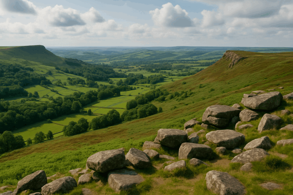
Most English hikers could name the Lake District peaks, rattle off a few Yorkshire Dales favourites, or describe the Cairngorms plateau in reasonable detail. Fewer could tell you much about the Long Mynd. That’s a genuine shame, because this broad, windswept ridge in south Shropshire is one of the most atmospheric upland areas in England, and it sits within easy reach of Birmingham, Wolverhampton, and the wider Midlands without ever feeling like it’s been trampled flat by weekend crowds.
I first walked the Long Mynd on a grey November morning, not quite sure what to expect beyond a vague promise of open moorland. Within twenty minutes of leaving the village of Church Stretton, I was out on the ridge with a cold westerly at my back and a view stretching over layer after layer of Shropshire hills. By the time I dropped into Carding Mill Valley and climbed back out again, I was already planning a return trip. That’s the effect this place has.

What actually is the Long Mynd?
The Long Mynd is a high moorland plateau roughly ten miles long and about three miles wide, sitting between Church Stretton to the east and the valleys of the River Onny and River West Onny to the west. The plateau itself tops out at around 516 metres at Pole Bank, which doesn’t sound dramatic until you realise that the surrounding terrain drops away sharply into a series of narrow, steep-sided valleys called batches, a very Shropshire word, that cut deep into the ridge from the east.
It’s managed largely by the National Trust, and most of the open moorland is designated as a Site of Special Scientific Interest. The heather, bilberry, and bog cotton up on the plateau are worth protecting; down in the batches, you get rushing streams, old sessile oaks, and that peculiar enclosed feeling you only get in steep, narrow hill valleys. The contrast between the two landscapes within a short walk is what makes the Long Mynd such good walking terrain. You can read more about how the right of way network opens up areas like this in our piece on the right of way rules every UK walker should actually understand.
The ancient trackways on the ridge
The broad back of the Long Mynd has been a routeway for thousands of years. The Portway, which runs roughly north to south along the ridge, is considered one of the oldest roads in Britain, a prehistoric trackway that drovers, traders, and travellers used long before tarmac was a concept anyone could imagine. Walking it today, you get a strong sense of that layered history. The views haven’t changed much. The wind probably hasn’t either.
The Portway is wide, grassy, and relatively easy going in dry conditions. In wet weather, and the Long Mynd gets its fair share, it can turn boggy in patches, particularly in the lower-lying sections near Asterton. Decent waterproofs and proper boots are non-negotiable up here. I’ve seen people attempt the ridge in road trainers and they always look faintly miserable by the time the first proper bog appears.
As well as the Portway, there’s a network of paths crossing the plateau and dropping into the various batches. The Jack Mytton Way, a 70-mile multi-use trail through Shropshire, passes through here too. Picking up sections of it on foot gives you a natural structure if you want a longer linear route rather than a circular day walk.
The drama of the batches
If the plateau is the Long Mynd’s headline, the batches are its best supporting act. Carding Mill Valley is the most visited, there’s a National Trust car park and café at the bottom, and the stream that runs through it feeds a small reservoir that’s been there since Victorian times. It’s busy by Long Mynd standards, though that still means pleasantly quiet by the standards of, say, Borrowdale on a bank holiday weekend.
Light Spout Hollow, which branches off Carding Mill Valley, is worth the extra legwork. The waterfall at its head is genuinely lovely, particularly after heavy rain when it throws itself over the rock lip with some force. Ashes Hollow, a little further south, is quieter and arguably more dramatic, it runs deep and narrow for a good mile before opening onto the plateau, with the path hopping back and forth across the stream. I’d put Ashes Hollow among the best short valley walks in the English Midlands, full stop.
Practical day walk ideas for Midlands visitors
Church Stretton is the obvious base. It’s accessible by train from Birmingham New Street via Shrewsbury, which makes it one of the more public transport-friendly upland destinations in England, something that matters more than people admit when you’re trying to justify leaving the car at home. The town itself is small but has a good pub, a couple of cafés, and enough accommodation to make an overnight stay easy to arrange.
A solid half-day circular starts in Church Stretton, climbs through Carding Mill Valley to the plateau, follows the ridge south towards Pole Bank, then drops back down via Ashes Hollow. That’s roughly 10 to 11 miles with around 450 metres of ascent, manageable for most reasonably fit walkers in about four to five hours. For a shorter version, cutting across from the head of Carding Mill Valley back down into the valley rather than continuing to Pole Bank keeps it under seven miles.
Those who want a longer day can push north along the Portway from the plateau towards Ratlinghope and loop back via the Batch Valley. That adds another four miles or so and takes you through some of the quieter western slopes where you’re unlikely to see many other walkers at all. Our guide on how far you can hike in a day in UK mountain terrain is worth a read before you commit to the longer options, especially if you’re new to upland walking.
What to watch out for on the Long Mynd
The plateau can be a seriously exposed place in bad weather. The Long Mynd is not the Alps, but don’t let the modest elevation fool you, cloud can descend fast, the temperature drops sharply when the wind picks up, and the open moorland offers no shelter whatsoever. Navigation is straightforward in good visibility, but in mist or low cloud the plateau can feel featureless quickly. A map and compass is sensible; relying solely on a phone signal is not, because coverage is patchy at best across much of the ridge.
The National Trust has more information on the Long Mynd and Carding Mill Valley, including seasonal access notes and updates on path conditions, on their website. The National Trust’s Long Mynd page is the best starting point for planning a visit.
The gliding club on the plateau is also worth knowing about. The Midland Gliding Club has operated from the Long Mynd since 1934, and the ridge lift created by westerly winds makes it one of the best soaring sites in England. Watching gliders circle silently overhead while you’re eating lunch on the Portway is one of those small, unexpected pleasures that the Long Mynd keeps throwing at you.
Why it stays under the radar
I think the Long Mynd suffers from proximity to better-known destinations. The Welsh hills are only a short drive west. The Peak District is an hour and a half north. The Lake District pulls Midlands walkers north whenever they have a full weekend free. The Long Mynd sits awkwardly between these bigger names, never quite managing to claim the same level of reputation despite genuinely deserving one.
That’s changing slowly. The Shropshire Hills AONB (now designated as a National Landscape) has a higher profile than it did a decade ago, and Church Stretton has started to market itself more deliberately as a walking destination. If you’re the sort of person who enjoys finding somewhere brilliant before the crowds do, now is a good time to go. If you want ideas for spending the night out rather than driving home the same day, our piece on bivvying in England and Wales covers the rules and practicalities.
The Long Mynd won’t hand you the drama of a Munro or the social cachet of a Wainwright. What it gives you instead is space, silence, ancient tracks, cracking valleys, and the particular satisfaction of finding somewhere genuinely good that most people walk straight past. That, for my money, is worth a lot.
Frequently Asked Questions
How do I get to the Long Mynd from Birmingham?
By train, take a direct service from Birmingham New Street to Church Stretton via Shrewsbury, the journey takes around an hour and a half. By car, the A49 from Shrewsbury brings you to Church Stretton in under an hour from Birmingham.
Is Long Mynd walking suitable for beginners?
Yes, with the right preparation. The plateau paths are mostly clear and the gradients are steady rather than severe. Beginners should stick to the Carding Mill Valley circuit, wear proper boots, carry a waterproof, and check the weather before heading up onto the open moorland.
Where is the best car park for the Long Mynd?
The National Trust car park at the bottom of Carding Mill Valley in Church Stretton is the most popular and practical starting point. There is a charge for non-National Trust members. There’s also parking near the Midland Gliding Club on the plateau itself if you want to start from the ridge.
What is the highest point on the Long Mynd?
Pole Bank is the highest point at 516 metres above sea level. It’s marked with a trig point and offers wide views across Shropshire, the Welsh hills, and on clear days as far as the Wrekin and the Malvern Hills.