
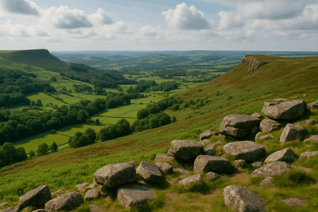
People hear “Malvern Hills” and picture a gentle English ramble. Sunday strollers, maybe. A flask of tea on a grassy bank. What they don’t expect is a proper ridge walk with near-vertical drops on either flank, views that stretch from the Black Mountains to the Cotswold escarpment, and a path that demands genuine respect when the wind is up. I’ve walked ridges in the Cairngorms and scrambled in Snowdonia, and I’ll tell you plainly: the Malverns surprised me. The elevation is modest, the Worcestershire Beacon, the highest point on the ridge, sits at 425 metres, but the exposure is real, and the physical effort is not to be underestimated.
Why the Malverns feel bigger than they look on paper
The hills rise almost without warning from the flat Severn plain. There’s no gradual build-up, no foothills to ease you in. You go from road or car park to steep grass flank in a matter of minutes, and once you’re on the ridge spine itself, you’re committed to a narrow crest with the whole of Worcestershire sprawling below you to the east and the Welsh borders rolling away to the west. That sudden verticality is what catches people out. The ascent to the Beacon from Wyche Cutting, for example, is only about 130 metres of climbing, but it’s relentless. Your legs know about it.
The reason the hills feel so exposed comes down to geology. The Malvern Hills are made of some of the oldest rocks in England: Precambrian gneisses and schists, around 680 million years old. These hard, resistant rocks refused to wear down at the same rate as the surrounding sedimentary landscape, leaving this narrow spine of ancient material jutting up like a spine above the plain. The Malvern Hills AONB explains it well on their official site, but you feel the story more clearly underfoot than you ever could reading about it. The rock is rough, grippy, honest. It doesn’t pretend to be something softer.
Malvern hills walking routes worth your time
The core route that most people do, and it’s core for good reason, is the main ridgeline from North Hill down to Midsummer Hill, covering around 10 miles end to end. But there are better ways to experience it than a simple linear trudge. A handful of circular options let you take in the full drama without needing a second car at the far end.
The Wyche Circular: Start at the Wyche Cutting car park, climb south to the Worcestershire Beacon, follow the ridge south past Jubilee Hill and Perseverance Hill, drop into Colwall or Eastnor, and return via the lower flanks. Around 8 miles with roughly 450 metres of total ascent. The views from the Beacon on a clear day are genuinely staggering, I could pick out the Brecon Beacons to the south-west and the Cotswolds to the east simultaneously. That’s a rare gift from a hill this small.
The North End Loop: Park in Great Malvern and take in North Hill and the Worcestershire Beacon before dropping back through the town. Shorter at around 5 miles, but the urban start and finish makes it accessible and the ascent earns its views. Great for a winter half-day when light is short.
The Midsummer Hill Circuit: This southern section is quieter and, I’d argue, underrated. Midsummer Hill has an Iron Age hillfort on its summit, one of the better preserved in the Midlands, and the surrounding woodland approaches are a different character to the open ridge further north. Around 4 miles, lower effort, but genuinely rewarding for those who want to pair history with walking.
Navigation and what to watch for on the ridge
The Malverns are well-signed and the paths are clear, but don’t let that breed complacency. The ridge has several spots where the ground falls away sharply, especially around the Beacon and along the sections between the Wind’s Point and British Camp (Herefordshire Beacon). In poor visibility, those drops become genuinely serious. Fog rolls in from the Severn Valley surprisingly quickly, and when it does, the landscape becomes completely disorienting. Keep a compass. Knowing how to read your map when the ground doesn’t match what you expect is a skill that matters even on hills this well-known, I’d point anyone who’s unsure towards a solid primer on reading contour lines in mountain conditions, because the principles apply here as much as anywhere.
Paths can get seriously muddy in winter and early spring, particularly on the eastern flanks where the soil is heavier. Good waterproof boots are non-negotiable. The kind of lightweight trail shoe that works fine on dry chalk downland will leave you miserable after a wet November week on these slopes. The Malvern Hills Trust does a good job maintaining the paths, but parts of the descents off the Beacon become genuinely slippery in the wet.
Getting there and using the hills wisely
Great Malvern has a railway station with direct trains from Birmingham New Street and Worcester Foregate Street, which makes the hills more accessible than many comparable walking destinations. You can genuinely do a full ridge day from London on the train: catch a morning train from Paddington to Worcester, change, and be on the hill before 10am. For those driving, the Wyche Cutting, British Camp, and Jubilee Drive car parks are the main options, though they fill early on summer weekends.
The Malvern Hills AONB covers around 105 square kilometres of protected landscape. The hills themselves are managed partly by the Malvern Hills Trust, a statutory body with powers to protect the common land, which means no fences, free roaming access on the open hillside, and a landscape that has looked broadly similar for centuries. That matters. It’s rare in England to have this kind of unfettered ridgeline access without needing to think carefully about land access rights at every turn.
A word on preparation and effort
The full north-to-south ridgeline traverse has around 800 metres of cumulative ascent when you factor in the repeated ups and downs between summits. That’s not a Munro, but it’s not a park stroll either. On a hot August day with a full pack, I found the Worcestershire Beacon section genuinely tiring, partly because there’s almost no shade on the open ridge and the sun hits you hard from both sides. Plan your water accordingly, there are no reliable sources on the ridge itself.
For those wanting to extend the day further or who enjoy linking landscapes, the Malverns sit close enough to the Brecon Beacons (now Bannau Brycheiniog) to make a multi-day trip viable, and the gentle Herefordshire countryside to the west is worth exploring on foot. If you’re the sort who likes to understand the physical demands before committing, our piece on training for upland walking is worth a read, the cardiovascular demands on a full Malvern ridge day are real, even if the numbers look modest.
Why the Malverns deserve more respect from serious walkers
There’s a tendency among experienced hill walkers to sniff at anything below 600 metres. I’ve done it myself. But the Malvern Hills sit in a category of their own: a dramatic, ancient ridge that delivers atmosphere, exposure and effort in a package that doesn’t require three hours of driving to reach. The geology is extraordinary, the views are vast, and the walking is honest. On a sharp autumn morning with the plain fog-filled below and the ridge catching sunlight, there are few places in England I’d rather be standing. Don’t overlook them because the numbers look small.